Imo State
In the pre-colonial period, what is now Imo State was a part of medieval Kingdom of Nri and the later Aro Confederacy before the latter was defeated in the early 1900s by British troops in the Anglo-Aro War.
Less than two months afterwards, the former Eastern Region attempted to secede in the three-year long Nigerian Civil War with Imo as a part of the secessionist, Igbo nationalist state of Biafra.
The present-day Imo State was captured by federal forces in early 1970 with Operation Tail-Wind taking the city and ending the war.
[14] A key minor industry is the extraction of crude oil and natural gas,[15] especially in Imo's north and west.
Despite unrest, with its fast growing population and industrialization, Imo State has the joint-sixth highest Human Development Index in the country.
[19][22] Profitable flora including iroko, mahogany, obeche, bamboo, rubber tree and oil palm.
[21][23][24] With high population density and over farming, the soil has been degraded and much of the native vegetation has disappeared.
[21] This deforestation has triggered soil erosion, which is compounded by heavy seasonal rainfall that has led to the destruction of houses and roads.
[27][28] They are mostly gully erosion found in Ideato, Orlu, Ihitte-uboma, Arondizuogu, Umuomi-ikeduru and Njaba areas of the state.
These gullies are attributed mainly to poor civil engineering works, specifically road/gutter construction as well as sand mining.
There is also no proper termination, spill way, and gabions to lower intense flow to non-erosion velocities during gutter construction.
Communities such as Ikeduru, Orlu, Ehime Mbano, Nwangele, Nkwerre and Mbaitoli dependent on stream and harvested rainwater for domestic use have been impacted due to surface water/stream pollution caused by intense runoffs from the gully sites.
[31] Available research identifies Oguta, Ohaji/Egbema, Ngor Okpala, Owerri West, Owerri North, Aboh Mbaise and Owerri municipal LGAs as very high flood areas; Mbaitolu, Ikeduru, Aboh Mbaise, Onuimo, IhiteUboma, Obowo and Ehime Mbano LGAs as moderate flood hazard areas; and northern of Isiala Mbano, Nwangele, Nkwere, Orlu, Ehime Mbano and Southern part of Ideato North, Okigwe and Ideato South LGAs as low flood hazard areas.
[32] In August 2019, flooding caused by heavy rain submerged about 70 houses, displaced 2000 villagers and destroyed farmlands in Orsu-Obodo community, in the Oguta local government area.
[19] Independent global brewer Heineken, through its subsidiary Nigerian Breweries, has significant investment in Imo State.
[19] The federal government has been called to inspect newly discovered oil-rich areas, which might help foster economic development and job creation.
[19] Oguta Lake, Palm Beach Holiday Resort in Awo-omamma, and a host of other tourist sites along the banks of the 26 km-length Njaba River present hotspots for tourism.
[54] One of the most remarkable riots that took place in Imo state, that led to the destruction of properties was the #ENDSARS protest.
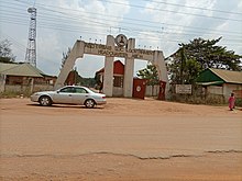
[78] In addition to its capital, other notable towns are Orlu, Obowo, Oguta, Awo-Omamma, Mgbidi, Mbaise, Okigwe and Ohaji/Egbema.
[82] This is a list of the higher institutions located in Imo State: Sam Mbakwe International Cargo Airport.