Indonesian archipelago
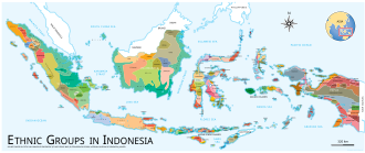
[10][11] The cultural heritage of the Indonesian archipelago reflects a profound diversity, encompassing hundreds of distinct ethnic groups and languages.
Its strategic location and natural resources have long made Indonesia an important trading center and a major player in regional and global affairs.
The term "Nusantara", often an alternative name for the Indonesian archipelago, comes from Old Javanese,[14][15] which emphasizes unity as a maritime nation with diverse cultures and vast landscapes.
The term is closely associated with the Majapahit era in Java, a period characterized by extensive maritime dominance in the region, which matched the boundaries of present-day Indonesia.
These paintings, which depict hand stencils and animal images, are about 40,000 years old, and provide valuable knowledge regarding the artistic expression of early humans.
Early trade networks facilitated the exchange of goods, ideas, and cultures between the islands and neighboring regions, including Mainland China, Indian subcontinent, and the Middle East.
In India's earliest epic, the Ramayana, Sugriva, the chief of Rama's army dispatched his men to Yawadvipa, the island of Java, in search of Sita.
[34][35][36] The earliest archaeological relic discovered in Indonesia is from the Ujung Kulon National Park, West Java, where an early Hindu statue of Ganesha estimated from the 1st century CE was found on the summit of Mount Raksa in Panaitan island.
[38][39] Srivijaya dominated trade in Southeast Asia for several centuries, controlling the strategic Malacca and Sunda Straits, as well as the world's Spice Route, and facilitating the spread of Hinduism and Buddhism throughout the region.
[42] Mataram Kingdom, ruled by the Sailendra and Sanjaya in Central Java during the 8th and 9th centuries, is renowned for successfully integrating two major religions—Hinduism and Buddhism—within a single government.
The Sailendra, adherents of Mahayana Buddhism, left an enduring legacy with the construction of Borobudur temple, the world’s largest Buddhist monument.
Under the leadership of powerful rulers such as King Hayam Wuruk and his prime minister Gajah Mada, Majapahit extended its influence over much of modern-day Indonesia, as well as parts of Malaysia, Singapore, and the Philippines.
[27][47][48] The European colonial era began in the early 16th century with the arrival of Portuguese explorers, who sought to control the lucrative spice trade.
The Dutch East India Company (VOC) emerged as the dominant colonial power, establishing a network of trading posts and fortresses across the archipelago.
The struggle for independence intensified in the early 20th century, with the rise of nationalist movements and organizations such as the Budi Utomo, Sarekat Islam, and the Indonesian National Party (PNI) founded by Sukarno.
[citation needed] The Proclamation of Indonesian Independence on August 17, 1945, by Sukarno and Mohammad Hatta, marked a pivotal moment in the archipelago's history.
The central and eastern regions, such as Sulawesi and the Maluku, are shaped by interactions of multiple plates, creating diverse geological features and island arcs.
[55] This vast area spans both the Asian and Australian biogeographic zones, resulting in a unique and rich array of flora, fauna, and marine life.
[56][57] Indonesian archipelago diverse ecosystems, ranging from lush rainforests to mangroves and savannas, support a variety of plant life.
Some of the most notable plants include the Rafflesia arnoldii, which produces the world’s largest flower, and the titan arum, known for its enormous inflorescence and distinctive odor.
The waters around Indonesia also support populations of large marine animals such as whale sharks, manta rays, and various species of sea turtles.
[59] The vibrant marine ecosystems not only support a wide range of species but also provide crucial resources and livelihoods for millions of Indonesians.