Ingen, Netherlands
It is a part of the municipality of Buren, and lies about 9 km south-west of Veenendaal.
The houses link to the townships De Ganzert and Eck en Wiel in the West.
The name could then come from Ingeborg, a god of the Vikings, or from the family Ingenhe from the 13th age.
The limes was a connection between the Castella (forts) of the northern part of the Roman Empire.
The history of the church is connected to the Commandry of St. John, a historic building in Nijmegen.
The village is built next to the river Nederrijn, a branch of the Rhine in the Netherlands.
The name Geldersweert [3] refers to a castle that stood west of the ferry in a floodplain.
The last noble owner was Anne Willen Jacob Joost Baron van Nagell, who inter alia was a chamberlain of King William III of the Netherlands.
The Germans manned the ferry, and the citizens weren't allowed to cross the Rhine any more.
A few weeks before the liberation, the Allies also began bombarding from Ede, what resulted in a grenade that came into the facade and the roof of the ferry house.
The Grebbeberg is a 50.2-metre high hill that was the central defensive point in 1940 for the centre and the west of the Netherlands.
But on the night of 3 December 1944 the Germans used an old Dutch defence: they destroyed the dikes of the Rhine south of Arnhem.
A part of the song translated into English goes like this: Once the Betuwe will be in bloom again, and will grow as one big, yellow grain.
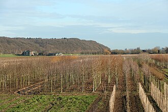
[4] Ingen lies next to the river Nederrijn and is thereby a very fertile area, which is a home to many orchards.
The government pushed the agriculture to a higher level because they wanted to compete on the world market with other countries.
[5] The statistical area "Ingen", which also can include the peripheral parts of the village, as well as the surrounding countryside, has a population of around 1,010.