Inner German border
On the Eastern side, it was made one of the world's most heavily fortified frontiers, defined by a continuous line of high metal fences and walls, barbed wire, alarms, anti-vehicle ditches, watchtowers, automatic booby traps and minefields.
Its route has been declared part of a European Green Belt linking national parks and nature reserves along the course of the old Iron Curtain from the Arctic Circle to the Black Sea.
Because of the unexpectedly rapid Allied advances through central Germany in the final weeks of the war, British and American troops occupied large areas of territory that had been assigned to the Soviet zone of occupation.
[16] In the early days of the occupation, the Allies controlled traffic between the zones to manage the flow of refugees and prevent the escape of former Nazi officials and intelligence officers.
[24] The relative openness of the border ended abruptly on 26 May 1952 when the GDR implemented a "special regime on the demarcation line", justified as a measure to keep out "spies, diversionists, terrorists and smugglers".
Barbed-wire fences were replaced with harder-to-climb expanded metal barriers; directional anti-personnel mines and anti-vehicle ditches blocked the movement of people and vehicles; tripwires and electric signals helped guards to detect escapees; all-weather patrol roads enabled rapid access to any point along the border; and wooden guard towers were replaced with prefabricated concrete towers and observation bunkers.
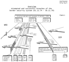
In early 1989, East German economists calculated that each arrest cost the equivalent of 2.1 million marks, three times the average "value" to the state of each working person.
[46] However, West German propaganda leaflets referred to the border as merely "the demarcation line of the Soviet occupation zone", and emphasised the cruelty and injustice of the division of Germany.
The Associated Press reported in 1976 that "Western tourists by the busload come out to have their pictures taken against the backdrop of the latest Communist walled city [and] the concrete blockhouse and the bunker-slits protruding from the green hillock where a collective's cows were grazing.
Elsewhere, V-shaped anti-vehicle ditches known as Kraftfahrzeug-Sperrgraben (KFZ-Sperrgraben) were installed along 829 kilometres (515 mi) of the border and were absent only where natural obstacles such as streams, rivers, gullies or thick forests made such barriers unnecessary.
This gave the guards a clear field of fire to target escapees and provided a buffer zone where engineers could work on maintaining the outward face of the fence in East German territory.
Security controls were imposed on the rest of the coast from Boltenhagen to Altwarp on the Polish border, including the whole of the islands of Poel, Rügen, Hiddensee, Usedom and the peninsulas of Darß and Wustrow.
Regular American soldiers manned the border from the end of the war until they were replaced in 1946 by the United States Constabulary,[91] which was disbanded in 1952 after policing duties were transferred to the German authorities.
[94] After the initiation of détente between East and West Germany in the 1970s, the two sides established procedures for maintaining formal contacts through fourteen direct telephone connections or Grenzinformationspunkte (GIP, "border information points").
In February 1986, the regime relaxed the definition of "urgent family business", which prompted a massive increase in the number of East German citizens able to travel to the West.
After the border was fortified and the Berlin Wall constructed, the number of illegal crossings fell dramatically and continued to fall as the defences were improved over the subsequent decades.
Events such as the crushing of the 1953 uprising, the imposition of collectivisation and East Germany's final economic crisis in the late 1980s prompted surges in the number of escape attempts.
An escapee in 1987 used meat hooks to scale the fences,[133] while in 1971 a doctor swam 45 kilometres (28 mi) across the Baltic Sea from Rostock almost to the Danish island of Lolland, before he was picked up by a West German yacht.
[137] The traffic was not one-way; thousands of people migrated each year from West Germany to the east, motivated by reasons such as marital problems, family estrangement and homesickness.
On 13 October 1961, Westfälische Rundschau journalist Kurt Lichtenstein was shot on the border near the village of Zicherie after he attempted to speak with East German farm workers.
[148] In one notorious shooting on 1 May 1976, a former East German political prisoner, Michael Gartenschläger, who had fled to the West some years before, was ambushed and killed by a Stasi commando squad on the border near Büchen.
[153] The regime named schools, barracks and other public facilities after the dead guards and used their memorials as places of pilgrimage to signify that (as a slogan put it) "their deaths are our commitment" to maintaining the border.
Its integrity had been fatally compromised in May 1989 when a reformist Communist government in Hungary, supported by the Soviet leader Mikhail Gorbachev, began to dismantle its border fortifications.
The closure produced uproar across East Germany[160] and the GDR government's bid to humiliate refugees by expelling them from the country in sealed trains backfired disastrously.
The East German leadership considered using force but ultimately backed down, lacking support from the Soviet Union for a violent Tiananmen Square-style military intervention.
The state was bankrupt, the economy was collapsing, the political class was discredited, the governing institutions were in chaos and the people were demoralised by the evaporation of the collective assumptions which had underpinned their society for forty years.
[177] The new East German leadership initiated "round table" talks with opposition groups, similar to the processes that had led to multi-party elections in Hungary and Poland.
Among the preserved sites are several dozen watchtowers, short stretches of the fence and associated installations (some of which have been reconstructed), sections of the wall still in situ at Hötensleben and Mödlareuth, and a number of buildings related to the border, such as the GDR crossing point at Marienborn and Teistungen.
[183][187] Substantial sections of the Kolonnenweg remain in place to serve as farm and forestry access roads, though the accompanying anti-vehicles ditches, fences and other obstacles have been almost entirely removed.
Artworks, commemorative stones, memorials and signs have been erected at many points along the former border to mark its opening, to remember its victims and to record the division and reunification of Germany.