Innisfail, Queensland
[2] Innisfail is the largest township of the Cassowary Coast Region and is known for its sugar and banana industries, as well as for being one of Australia's wettest towns.
In March 2006, Innisfail gained worldwide attention when Tropical Cyclone Larry passed over, causing extensive damage.
[10] It is located near large tracts of old-growth tropical rainforest surrounded by vast areas of extensive farmlands.
Queensland's highest mountain, Mount Bartle Frere, part of Australia's Great Dividing Range, is 15 kilometres (9 mi) to the north.
[12] Innisfail experiences a tropical rainforest climate (Köppen: Af) and has no month with an average temperature below 18 °C (64.4 °F) or with less than 60 millimetres (2.4 in) of rainfall.
[18] High rainfall associated with these storms, combined with Innisfail's riverside location often causes flooding.
Meanwhile, sun data was borrowed from the South Johnstone EXP weather station, 9.7 km SW of Innisfail.
Prior to European settlement the Innisfail area was occupied by five separate societies of the Mamu people.
Sub-Inspector Robert Arthur Johnstone of the Native Police came with the intention of rescuing remaining survivors and collectively punishing Aboriginals thought to have killed a number of the shipwrecked crew.
[22] Johnstone wrote very highly of the area, stating:A most glorious view appeared – a noble reach of fresh water, studded with blacks with their canoes and catamarans, others on the sandy beaches; deep blue fresh water expanding to an imposing breadth.In October 1873, Johnstone again returned as part of the Northeast Coast Expedition led by the explorer George Elphinstone Dalrymple.
British settlement was first established at the junction of the north and south branches of the Johnstone River by this expedition on 5 October 1873.
[23] Later in 1879, Irishman Thomas Henry Fitzgerald arrived in the area to establish a sugar industry at his Innisfail Estate (now the locality of that name).
The house built by Fitzgerald and thus the first establishment in the area was called Innisfallen, after the largest island in the Lakes of Killarney, Ireland.
[4][25] It was Margaret-Mary Noone a long time resident of the area who suggested the name Innisfail as a way to honour T.H Fitzgerald's pioneering efforts and Ireland[26][27] Johnstone River Post Office opened on 1 November 1882 (a receiving office had been open from 1880), was renamed Geraldton two months later and Innisfail in 1910.
Aboriginal and Torres Strait workers, Chinese miners who developed the banana industry and retail businesses.
[32][33] Geraldton Provisional School opened on 18 July 1887 in the present-day Anzac Memorial Park on the corner of the Bruce Highway and Ernest Street (17°31′26″S 146°01′40″E / 17.5239°S 146.0278°E / -17.5239; 146.0278 (Geraldton / Innisfail State School (original site))) with an initial enrolment of 15 boys and 13 girls under head teacher Thomas Edward White.
When the Sisters were no longer able to lead the school, it was briefly led by the Marist Brothers until the first lay principal was appointed in 1982.
[39] In 1906, Patrick Leahy established the Johnstone River Advocate newspaper, with the first issue published in December that year.
[44][45] A huge cyclone swept through Innisfail on 10 March 1918, causing immense damage and killing many people.
[46] As a result, Innisfail is now considered one of the best Australian towns for Art Deco and Streamline Moderne architecture.
Donald Bradman was part of the international team, led by New South Wales Captain, Alan Kippax in 1931.
[61] On 3 July 1970, Innisfail State School introduced a special education program called Opportunity Classes.
The swift response of the Australian Defence Force was praised by many and the cleanup campaign they orchestrated allowed for total utilities restoration within 3 weeks.
[63] Cyclone Larry was a direct and primary cause of the widely reported and dramatic surge in banana prices in Australia.
[64][65][66] After the cyclone the township underwent something of an economic boom that stemmed from an influx of tradespeople and business eager to capitalise upon relatively significant insurance payouts.
[69][70] In 2011, in the early morning of 3 February, Cyclone Yasi crossed the far north Queensland coast causing damage to the Innisfail area.
[82] The Innisfail branch of the Queensland Country Women's Association meets at the CWA Hall at 1 McGowan Drive.
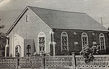
[83] Chinese Australians built the Innisfail Temple/Lit Sing Gung (列聖宮) in Owen Street, which is now open to other races and religions.
Tourism is of importance to the township and the town consistently seeks to attract visitors passing through on the Bruce Highway.