International Boundary Marker
The marker was created in 1840 and placed in 1841 to mark the international border between the United States and the Republic of Texas.
The survey which established this border lasted from May 1840 to June 1841; the survey team faced hazardous, swampy conditions in their work and were forced to take several extended breaks due to weather and a lack of funding.
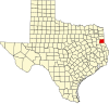
[2][3] The property of the 3 acres (1.2 ha) area is shared between DeSoto Parish, Louisiana (1 acre) and Panola County, Texas (2 acres), with the marker itself being a direct property of U.S. Government[3] The marker was added to the National Register of Historic Places on April 13, 1977.
[1] In 1980, the marker was designated as a State Historic Civil Engineering Landmark by the Texas and Louisiana Sections of the American Society of Civil Engineers.
This article about a property in Texas on the National Register of Historic Places is a stub.