International Geophysical Year
[1][2] The IGY encompassed fourteen Earth science disciplines: aurora, airglow, cosmic rays, geomagnetism, gravity, ionospheric physics, longitude and latitude determinations (precision mapping), meteorology, oceanography, nuclear radiation, glaciology, seismology, rockets and satellites, and solar activity.
[4] Other significant achievements of the IGY included the discovery of the Van Allen radiation belts by Explorer 1 and mid-ocean submarine ridges, an important confirmation of plate-tectonic theory.
On 5 April 1950, multiple scientists (including Lloyd Berkner, Sydney Chapman, S. Fred Singer, and Harry Vestine) met in James Van Allen's living room and suggested that the time was ripe to have a worldwide Geophysical Year instead of a Polar Year, especially considering recent advances in rocketry, radar, and computing.
[12] Project Vanguard would be managed by the Naval Research Laboratory and to be based on developing sounding rockets, which had the advantage that they were primarily used for non-military scientific experiments.
After several failed Vanguard launches, Wernher von Braun and his team convinced President Dwight D. Eisenhower to use one of their US Army missiles for the Explorer program (there was not yet an inhibition about using military rockets to get into space).
The British–American survey of the Atlantic, carried out between September 1954 and July 1959, discovered the full length of the mid-Atlantic ridges (plate tectonics); it was a major discovery during the IGY.
In fact, because of the war, much of the data collected and scientific analyses completed during the 1932 Polar Year were lost forever, something that was particularly troubling to the IGY organizing committee.
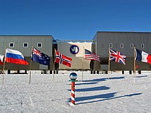
In addition, each host country agreed to abide by the organizing committee's resolution that there should be a free and open exchange of data among nations.
[19][20][21] ICSU-WDS goals are to preserve quality-assured scientific data and information, to facilitate open access, and promote the adoption of standards.
The International Council of Scientific Unions, a parent body, broadened the proposals from polar studies to geophysical research.
As a part of the IGY activities, a two-man camp was installed beside Taylor Glacier, 60 miles (97 km) west of Mawson.
Its principal purpose was to enable parallactic photography of the aurora australis (thus locating it in space), but it also permitted studies of Emperor penguins in the adjacent rookery.
The 1957 winterers were retrieved by helicopter, but bad weather prevented going back for the station's 15 sled dogs, which were left chained up.
As a forerunner expedition, the ship Commandant Charcot of the French Navy spent nine months of 1949/50 at the coast of Adelie Land.
[30] In December 1958, four team members were stranded several hundred kilometers inland when one of the skis on their light aircraft broke on landing.
It survived intact for 53 years, but was slowly buried in the ice (as all structures there eventually sink into the icy crust), until it was demolished in December 2010 for safety reasons.
For example, the work of the IGY led directly to the Antarctic Treaty, which called for the use of Antarctica for peaceful purposes and cooperative scientific research.
Since then, international cooperation has led to protecting the Antarctic environment, preserving historic sites, and conserving the animals and plants.