International waters
As such, states have the right to fishing, navigation, overflight, laying cables and pipelines, as well as scientific research.
[4] The high seas make up 50% of the surface area of the planet and cover over two-thirds of the ocean.
UNCLOS also contains, in its part XII, special provisions for the protection of the marine environment, which, in certain cases, allow port States to exercise extraterritorial jurisdiction over foreign ships on the high seas if they violate international environmental rules (adopted by the IMO), such as the MARPOL Convention.
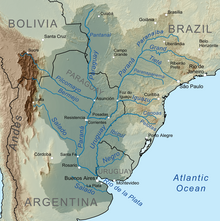
[8] When an underground water crosses international boundaries, the term transboundary aquifer applies.
The importance of this approach is that the physical properties of aquifers become merely additional variables within the broad spectrum of the transboundary nature of an aquifer: social (population); economic (groundwater efficiency); political (cross-border); existing research or data; water quality and quantity; other issues that drive the agenda (security, trade, immigration, etc.).