Interstate 24
The Interstate has facilitated the rapid growth of the largest suburban corridor in the Nashville metropolitan area, which runs for more than 30 miles (48 km) southeast of the city and is considered the most congested stretch of highway in the state.
Passing through the Hendron and Farley communities adjacent to Paducah, the highway shifts into a direct east–west alignment several miles later and has an interchange with US 68 in Reidland.
Some distance later, the freeway enters a landscape consisting mostly of farmland and dips briefly into the southern tip of Caldwell County, where it has an interchange with KY 139.
Passing over the next several miles through additional farmland and bypassing Hopkinsville to the southwest, the Interstate reaches the southern terminus of I-169 at a trumpet interchange.
About four miles (6.4 km) later, the Interstate has a partial cloverleaf interchange with US 41 Alternate, which provides access to Hopkinsville to the north and Fort Campbell and Clarksville, Tennessee, to the south.
[9] I-24 crosses into Tennessee from Kentucky traveling in a southeasterly-to-northwesterly direction into Montgomery County and serving as a major means of access to St. Louis and Chicago to the northwest.
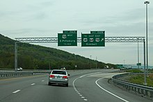
Immediately within the eastern outskirts of Clarksville, the fifth-largest city in Tennessee, the Interstate reaches an interchange with State Route 48 (SR 48), less than one mile (1.6 km) later, which provides access to Trenton in Kentucky to the north.
Leaving Clarksville, the highway enters a long straight section with several steep grades and crosses into Robertson County a short distance later.
Several miles later, the Interstate reaches an interchange with SR 49 near Pleasant View and Coopertown, which provides access to Springfield to the northeast and Ashland City to the southwest.
Over the next three miles (4.8 km) beyond this point, the Interstate crosses over another steep hill, utilizing truck lanes on both the eastbound and westbound ascent before reaching Nashville at SR 155 (Briley Parkway).
Leaving Smyrna, the route enters an unincorporated urban area, before reaching a three-level interchange with I-840, the outer southern beltway around Nashville.
Leaving Manchester, the Interstate maintains its relatively straight trajectory and passes through the northeastern corner of Arnold Air Force Base over a distance of about three miles (4.8 km).
The Interstate then travels over the next 10 miles (16 km) through a wide swath of mostly farmland, before entering Grundy County and reaching an interchange with US 64 and SR 50 near the town of Pelham, where it begins a concurrency with the former route that is largely unsigned.
After descending Monteagle, I-24 travels for several miles through a vast flat gorge within the plateau characterized by long straightaways and few curves before reaching an interchange with US 72 near Kimball and South Pittsburg, where US 64 splits off.
About two miles (3.2 km) later, the Interstate curves sharply to the east, traveling on a narrow artificial causeway between the Tennessee River to the north and the northern tip of Lookout Mountain to the south.
The route was initially slated to pass near 38th Street through the Alton Park and East Lake neighborhoods, but was moved approximately 1.5 miles (2.4 km) north in August 1955.
[17][18] In 1957, officials in Tennessee, Kentucky, Illinois, and Missouri began an effort to extend I-24 west of its allocated western terminus in Nashville to St. Louis; however, each of the states had difficulty reaching an agreement on the proposed routing.
[20] The four governors also urged the approval of a new east–west Interstate Highway to run between Hayti, Missouri, and Jackson, Tennessee, incorporating a then-unbuilt bridge across the Mississippi River that had been proposed since the early 1940s.
[16][41] To construct the segment at the foot of Lookout Mountain west of downtown Chattanooga, engineers shifted the river channel to the north in order to avoid impeding the flow.
[45] The stretch between US 41 in Lookout Valley and the interchange with I-59 in Dade County, Georgia, was jointly opened to traffic by both states on September 10, 1968, along with the eight-northernmost-miles (13 km) of I-59.
[59][60][61] Once construction on the remainder of I-24 between Clarksville and Nashville was underway, the route was projected to be completed in late 1974 or early 1975, but would experience further delays as a result of geological problems.
[77] The 2.5-mile (4.0 km) section between US 62 near Calvert City and KY 453, including the Tennessee River Bridge, which had been completed approximately five years prior, was opened to traffic on October 25, 1979.
[81] Construction on the bridge began in 1972, but issues caused by unusual rock formations at the site, believed to have been formed by the 1811–1812 New Madrid earthquakes or earlier quakes, delayed completion and resulted in the cost nearly tripling.
[77][84] In November 1977, the Tennessee Department of Transportation (TDOT) installed a system to detect tailgating vehicles in the westbound lanes of the concurrent segment with I-40, which consisted of sensors embedded in the roadway connected to overhead warning signs with flashing lights and horns.
[88][89] A project began in April 1985 that extensively straightened and rebuilt the eastbound lanes of I-24 on the eastern downgrade of Monteagle Mountain and reduced the grade.
[95] The original interchange with I-75, which was a simple directional T design, had repeatedly been ranked as one of the top 10 worst freight bottlenecks in the US by the American Transportation Research Institute and contained several sharp curves and other safety hazards.
[102][103] The project consisted of eliminating left-hand entrance and exit ramps from I-75 onto I-24, straightening curves, widening I-75 to six lanes through the interchange, widening two ramps from I-75 to I-24 to three lanes, replacing two overpass bridges, and construction of a collector–distributor facility that carries traffic directly from US 41 and the Tennessee Welcome Center along I-75 northbound, providing direct access to both I-75 northbound and I-24 westbound.
The first phase, which ran from October 2018 to December 2021, included the construction of emergency pull-offs, improvements to multiple entrance and exit ramps, the erection of additional roadside dynamic-message signs (DMSs), and upgrades to traffic signals along the corridor.
[111] The accident was investigated by the National Transportation Safety Board (NTSB), which named a number of unsafe design features of the bridge as contributors to the crash.
In 1979, structural problems were discovered on the Ohio River Bridge, including 119 cracks as a result of defective welding in the tie girders.