Interstate 25 in Colorado
It is a typical four-lane Interstate Highway, and its entire route in Colorado lies close to the east side of the Rocky Mountains.
For the next 30 miles (48 km), I-25 continues north through the rural areas of Colorado until it reaches the small city of Walsenburg, where State Highway 25C (Interstate 25 Business, I-25 Bus.)
In Colorado City, I-25 interchanges with the east end of the Frontier Pathways Scenic and Historic Byway (SH 165) at exit 74.
[6] After leaving Pueblo, I-25 continues up north with the Union Pacific Railroad line paralleling closely to the route on the right side after interchanging with Porter Draw at exit 106.
The Interstate leaves Colorado Springs between exits 153 and 156, where I-25 enters the United States Air Force Academy, going through the east side of the institution.
I-25 then continues north through more rural and hilly areas east of the Rocky Mountains until reaching Castle Rock at exit 181.
After entering Arapahoe County, I-25 cuts through the Denver Technological Center (DTC) between Dry Creek Road and Belleview Avenue (exits 196 and 199).
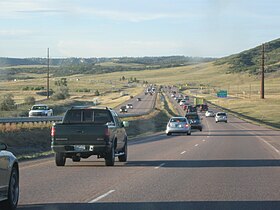
As I-25 continues north, it moves through rolling farm and grasslands with the Front Range and high mountains clearly visible to the west while passing through a medley of lakes and reservoirs.
It stays generally flat with few moderate climbs in elevation, while also serving smaller cities like Dacono and Firestone to the east and Longmont to the west.
The highway runs on the eastern side of Fort Collins, serving Colorado State University at exits 268 and 269 (which is also the most direct route to downtown).
[5][6] Colorado had begun planning of a modern intercity route along the Front Range as early as 1944, well before the national movement toward an Interstate Highway system.
This route was upgraded with the help of the federal government to become US 85 and US 87 by 1930, now paved in concrete and shortening the travel time between Pueblo and Colorado Springs to just one hour.
The city of Colorado Springs followed a similar theme with their Monument Valley Freeway, begun in 1955 and completed by July 1960.
Linking to New Mexico in the south would prove more problematic as the planned route had to stretch over Raton Pass, and its accompanying 1,800-foot (550 m) elevation change, within just 13 mi (21 km).
This meant that four lanes of high-speed, nonstop freeway were finally open for a full 305 miles (491 km) from New Mexico north to Wyoming.
The first of these was Transportation Expansion (T-REX), which widened and expanded nearly 17 miles (27 km) of both I-25 and the I-225 bypass in the Denver Metropolitan Area as well as adding various pedestrian and aesthetic improvements.
[9] The major goals of COSMIX, which began in 2005 and was completed a year and four days ahead of schedule at the very end of December 2007, were a general expansion and widening of the corridor to three lanes in each direction throughout the city, as well as the reconstruction of two main interchanges (at Bijou Street near downtown Colorado Springs, and at Rockrimmon Boulevard and North Nevada Avenue in the city's growing north side).
COSMIX was the first funded portion of a larger plan for I-25 improvements as detailed in an Environmental Assessment approved by CDOT and FHWA in 2004.
[11] An EA-recommended improvement not included in COSMIX due to funding limitations was the reconstruction of the I-25 interchange at Cimarron Street (US 24 West).
In 1996, Seymour Cray was mortally wounded in a rollover accident while merging onto the highway at the North Academy Boulevard interchange.
His death--while under investigation-- shook up the comic book community, and invoked calls for further measures to ensure public safety on the highway.
Enhancements include the widening of two bridges, noise wall installation, the softening of curves for better safety, and the addition of acceleration and deceleration lanes.
Efforts to improve these conditions are underway, and the project is completed with a cost of $350 million, with contributions from Douglas and El Paso counties, Pikes Peak Rural Transportation Authority and a federal INFRA grant.