Interstate 290 (Illinois)
[6] I-290 connects I-90 (Jane Addams Memorial Tollway) in Rolling Meadows with I-90/I-94 (John F. Kennedy Expressway/Dan Ryan Expressway) near the Loop.
[citation needed] Here, I-290 runs largely above-grade through Schaumburg and Elk Grove Village and at- or below-grade through Itasca and Addison.
Exit 15 to southbound I-294 is a frequent point of congestion due to ramp traffic backing up onto the mainline highway, often as long as two miles (3.2 km).
Finally, there is a dangerous high-volume weaving situation at the end of the ramp to I-294 with southbound I-294 traffic exiting to westbound I-88.
[citation needed] The western three miles (4.8 km) of this section are blacktop, while east of IL 83 (exit 10) the original concrete is still in place.
After Mannheim Road, the highway immediately narrows to three lanes in width, causing mile-long (1.6 km) backups.
These cause backups as trucks switch lanes to exit and a large volume of traffic enters on the left side of the highway.
In 2001–2002, this section between milemarkers 15 and 18 was reconstructed in the first phase of an attempt to untangle the "Hillside Strangler", adding the local lanes and extra onramp to I-290.
The easternmost section of I-290 is seven miles (11 km) long and runs entirely through the city of Chicago to the terminus at I-90/I-94.
This highway is four lanes wide in both directions for its entire length, and most onramps and offramps are located just two blocks apart.
Eastbound congestion is lighter here than through the "Avenues", generally limited to congestion on the tight onramps to the Kennedy and Dan Ryan expressways (Jane Byrne Interchange) at the eastern terminus or blind onramps at Kostner and Homan avenues.
[citation needed] Westbound, congestion is heavy starting at Laramie due to the left-hand exit at Austin (which combines a "perfect storm" of a four-down-to-three lane reduction, an unfamiliar left-hand exit, and entrance and in-merging traffic of the central onramp).
[citation needed] Most afternoons, this bottleneck can skyrocket the "Post Office to Wolf (Road)" commute time to over an hour (up from 16 minutes with no traffic).
After Cicero, the line leaves the median and runs on the south side of the Eisenhower for the remainder of its route to Des Plaines Avenue, Forest Park.
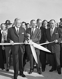
Use of the automobile boomed in the 1920s, leading to extreme traffic on Chicago's west side and the first serious plans of an expressway by Congress Street in the early 1930s.
[11] The expressway is named for the former President Dwight D. Eisenhower, who signed the Federal-Aid Highway Act of 1956 and came up with the original concept for the Interstate Highway System; it originally was called the Congress Expressway because it partially follows the route of Congress Parkway (portions now called Ida B.
The first implementation utilized a police officer at the top of an entrance ramp, stopping and releasing vehicles onto the highway at a predetermined rate.
In spite of its unused state, the building is still known to visitors and commuters alike as the unofficial gateway into the Loop area.
[20] In late August 2009, the USPS announced an auction was to be held to sell the facility to the highest bidder.
The Eisenhower was the first expressway in the heart of Chicago, yet for its $183 million cost, the thousands of people displaced, and the neighborhoods torn up, traffic congestion did not improve.
A local newspaper, the Garfieldian, wrote in 1951, Organized hoodlums, vandals, morons and just ordinary scavengers loot the vacant buildings that are to be wrecked to make way for the Congress St. highway in broad daylight as well as at night time.
The abundance of prowlers and other undesirable characters in the neighborhood has made residents, especially women, afraid to go out at night.