Interstate 8
It runs from the southern edge of Mission Bay at Sunset Cliffs Boulevard in San Diego, California, almost at the Pacific Ocean, to the junction with I-10, just southeast of Casa Grande, Arizona.
Several controversies erupted during the construction process; questionable labor practices in Imperial County led to the federal conviction of mobster Jimmy Fratianno, and a U.S. House of Representatives subcommittee found that the Arizona government had mismanaged financial resources.
Since then, the freeway through San Diego has been widened due to increasing congestion, and another portion in Imperial County had to be rebuilt following damage by the remnants of Hurricane Kathleen.
East of El Cajon, it ascends into the mountains and the Cleveland National Forest, traveling through towns such as Alpine then going by the Viejas Casino before reaching Pine Valley.
[11] However, this resulted in smugglers driving the wrong way on I-8 at high speeds in order to avoid the checkpoint, causing several crashes, even after concrete barriers were installed.
At the Mountain Springs/In-Ko-Pah grade, the freeway is routed down two separate canyons—Devils Canyon for westbound traffic and In-Ko-Pah Gorge for eastbound traffic—as it descends 3,000 ft (910 m) in 11 mi (18 km).
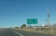
[18] The route enters the Imperial Valley, where it intersects with SR 98, a highway leading to Calexico, and passes near the Desert View Tower.
[19] The freeway then traverses the Imperial Sand Dunes Recreation Area and intersects with SR 186 leading south to Baja California Norte, Mexico.
In the Gila Mountains, the eastbound lanes of I-8 cross under the westbound freeway, briefly traveling to the left near Telegraph Pass before reverting.
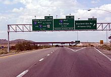
Through this part of Arizona, I-8 passes along the northern edge of the Barry M. Goldwater Air Force Range and to the south of the Yuma Proving Ground.
I-8 reaches its eastern terminus southeast of Casa Grande Mountain Park at an interchange with I-10, which continues north (westbound) to Phoenix, and south (eastbound) to Tucson.
[47] The eight-lane freeway was projected to relieve traffic in the Frontier Street area coming from the San Diego Sports Arena.
[54] Even before the freeway was complete in California, bidding began in 1964 on widening I-8 from six to eight lanes between near Fairmount Avenue and Spring Street, in San Diego and La Mesa.
[84][85] The Los Angeles Times described the stretch east of Mountain Springs as follows: "Through it the freeway engineers have hacked two separate roadways not even in sight of each other, but so overpowering in the sheer magnitude of the cuts through the mountains that it is almost impossible to believe human beings could have so overpowered hostile nature ...."[86] Access to the site for construction workers was difficult, and many slopes had to be stabilized.
[97] A 3.7-mile (6.0 km) section to the east of Alpine was scheduled to have bidding opened in November of that year, and was to be finished in 1968; this would produce a continuous freeway from San Diego to the eastern terminus of this route.
The third project was built near the site of an abandoned attempt to build a tunnel for the old highway after World War II, which proved to be too expensive.
[108] Due to financial concerns, it was announced in September 1968 that the target date for completing the Interstate Highway System would be extended until 1974, from 1972.
Caltrans engineer Jacob Dekema stated at the time that the four-lane freeway would not be constructed on the US 80 routing due to possible expansion of the Naval Air Facility El Centro.
[128] The next year, Dekema indicated that the goal was to have I-8 completed by 1973, citing a deadline in order to have the federal government pay for up to ninety percent of the costs; the other freeways in the region were to be delayed because of this.
[134] The 16-mile (26 km) portion of I-8 bypassing Holtville began construction in December 1969, and was nearing completion in May 1971, to result in a continuous freeway that connected two existing segments from Crestwood in San Diego County to just west of Winterhaven.
[43] However, Holtville residents raised concerns about SR 115 providing the only access to the eastern part of the city,[135] notably the narrow and curved portion leading from the freeway into town.
In addition to this, construction of the Highline Canal overpass involved a 120-foot (37 m) steel span that was prefabricated and made of girders that were hoisted into position by barges.
[137] The last 6.5-mile (10.5 km) part of the California portion, from near Algodones Road to west of the Arizona state line, was to enter the bidding phase in early 1972.
[142] Following Tropical Storm Kathleen in September 1976, a flood eroded 400 pieces of the roadway from westbound I-8 near Ocotillo, resulting in the construction of a detour.
[154] In later years, the Southern Pacific Railroad was constructed, paralleling the Gila River east of Fortuna;[155] by 1877, the tracks were complete to Yuma.
[164] Drivers were told to bring spare fan belts, radiator hoses, and additional drinking water for the journey traversing the desert.
In late 1958, a group of motel owners whose properties were located on SR 84 strongly objected to any routing of I-8 that would not go through the city of Casa Grande.
[174] A new park was to be built east of the Colorado River crossing, just opposite downtown; city officials hoped that this would give an improved look to the town as drivers first arrived.
The Arizona Highway Department was specifically cited in the report for not taking into account protecting government interests when selecting labor for the projects.
[190] Some Yuma businesses had noticed a decrease in revenue at this time; the Arizona Highway Department agreed to modify some signs to eliminate any confusion.