Interstate 86 (Pennsylvania–New York)
When projects to upgrade the existing NY 17 to Interstate Highway standards are completed, I-86 will extend from I-90 near Erie to the New York State Thruway (I-87) in Woodbury.
In New York, the current and future alignment of I-86 is known as the Southern Tier Expressway west of I-81 in Binghamton and the Quickway east of I-81.
The Southern Tier Expressway section of I-86 and NY 17 comprises Corridor T of the Appalachian Development Highway System.
The I-86 designation was assigned on December 3, 1999, to the entirety of since-decommissioned Pennsylvania Route 17 (PA 17) and to the westernmost 177 miles (285 km) of NY 17.
It heads to the southeast, meeting PA 89 at exit 3 before curving to the east and crossing into New York, where it becomes concurrent with NY 17.
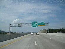
This summit, at 2,110 feet (640 m) above sea level, is the highest point along I-86, located between exits 32 (West Almond) and 33 and marked with a sign.
However, where the railroad turns southeast to Hornellsville, I-86 continues northeast across a summit and into the wide Canisteo River valley (exit 34).
I-86 runs alongside Goff Creek from Howard to the wide Cohocton River valley, where it meets the south end of I-390 (exit 36) near Avoca and turns southeast through that valley, parallel to the Erie's Rochester–Painted Post line (Buffalo, New York, and Erie Railroad).
[8] By the late 1940s, the portion of NY 17 through the Catskill Mountains and Orange and Rockland counties had become prone to massive traffic jams due to both its winding and narrow composition and congestion in the villages and hamlets along the highway.
[9] To the west, a section of the highway through Sullivan and Delaware counties was built over the right-of-way of the defunct New York, Ontario and Western Railway.
The gap between Wurtsboro and Fair Oaks in Orange County was filled on October 23, 1958, while the section between Ferndale and Rock Hill was completed in two stages.
Despite flaws in the highway's design—it included a grade-level railroad crossing near Fair Oaks (since removed) and two stretches with intersections and driveway access—the Quickway succeeded in easing travel through southern New York, cutting the driving time in half and the accident rate by 70 percent.
[13][14] The Coldspring to Salamanca section was built out of necessity: in 1967, the first stress test of the Kinzua Dam had submerged part of the original NY 17 into the Allegheny Reservoir and made it impassable.
As part of an agreement made between the two states, Pennsylvania acquired the necessary right-of-way and easements for the freeway at the expense of New York.
The protest was organized in part by two owners of property in the path of the highway and involved the construction of an encampment on the right-of-way of the Southern Tier Expressway.
The state had conducted studies on realigning the highway to bypass the disputed section;[32] however, the Indians vacated the encampment five days later.
The completion of the Corning Bypass, remedying the last substantial gap in the freeway, created a continuous, mostly limited-access highway between Erie, Pennsylvania, and Harriman, New York.
The completed highway, designated as PA 17 and NY 17,[34][35] served as a time-saving, toll-free alternate route to the Thruway for motorists going from the New York City area to Ohio and points west.
[citation needed] The portion of the two-state freeway from I-90 near Erie to I-81 in Binghamton is designated as Corridor T of the Appalachian Development Highway System.
[36][37] In 1998, all of PA 17 and the portion of NY 17 from the Pennsylvania state line to Harriman were designated "High Priority Corridor 36" in the Transportation Equity Act for the 21st Century (TEA-21).
[38] New York politicians, including Senator Daniel Patrick Moynihan, and businesspeople backed the move in the hope that an efficient, high-speed roadway would inspire companies to start or expand their businesses in the state's southern counties.
[40] The American Association of State Highway and Transportation Officials (AASHTO) formally approved the designation on November 6, 1998, as "Future I-86".
[citation needed] The designation was extended eight miles (13 km) eastward to NY 14 in Horseheads on January 28, 2004,[42] after that section had been upgraded.
The completion of the $30-million (equivalent to $43.6 million in 2023[21]) project increased the total mileage of I-86 to 195 miles (314 km)[44] and created a temporary gap in the designation.
[49] In 1998, then-Governor George Pataki signed legislation to convert the entirety of NY 17 to an interstate and stated that the conversion would be fully completed by 2009.
[50] Aside from numerous minor interchange improvements, major work includes constructing two new interchanges in the mountainous Hale Eddy area, exits 85 and 86, to replace two at-grade intersections, as well as the relocation of driveways in that area, improving curve radiuses throughout the route, and widening the shoulders on narrow parts of the highway.
As part of the project, a four-ramp parclo was built, which replaced the prior exit 125, located 4,000 feet (1.2 km) west.
In October 2022, Governor Kathy Hochul announced that a draft environmental impact statement on upgrading Route 17 to transform it into Interstate 86 was underway, public outreach was expected early in 2023, and that up to $1 billion was available for the work.