Interstate 94 in Michigan
I-94 then runs through Jackson, Ann Arbor, and portions of Metro Detroit, connecting Michigan's largest city to its main airport.
Past the east side of Detroit, the Interstate angles northeasterly through farmlands in The Thumb to Port Huron, where the designation terminates on the Blue Water Bridge at the Canada–United States border.
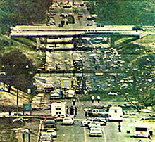
Since completion, I-94 has remained relatively unchanged; a few interchanges have been rebuilt, a second span was constructed for the Blue Water Bridge, and, in 1987, a plane crashed on the freeway during takeoff from the airport in Detroit.
The entire length of I-94 is listed on the National Highway System,[3] a network of roadways important to the country's economy, defense, and mobility.
The freeway runs northeasterly through rural Michiana farmland in the southwestern corner of the Lower Peninsula and parallels the Lake Michigan shoreline about three miles (4.8 km) inland.
The freeway intersects the eastern end of Business Spur I-94 (BS I-94) at a partial interchange near Morrow Lake in the township.
[6][7] Before crossing into Calhoun County on the west side of Battle Creek,[1] I-94 has the only driveway on any of Michigan's Interstate Highways for a gate providing access for military vehicles into the Fort Custer Training Center.
East of the river crossing, the freeway meets an interchange for M-96, M-311, and the eastern end of the Battle Creek business loop near FireKeepers Casino Hotel in Emmett Township.
I-94 jogs southeasterly around the south side of Willow Run Airport complex, separating from US 12 and entering Wayne County.
The freeway continues to parallel the lakeshore and travels to the west of Selfridge Air National Guard Base in Harrison Township.
Immediately west of downtown Port Huron, it intersects I-69; the two freeways merge and turn first east and then north through an interchange that also features connections to BL I-69.
On the eastern bank of the river, there is one final interchange for M-25 and BL I-69/BL I-94 before the freeway reaches the toll and customs plazas for the twin-span Blue Water Bridge.
Past these plazas, I-94/I-69 ascends the approach to the bridge which crosses the St. Clair River to Point Edward (Sarnia), Ontario.
[13] The State Trunkline Highway System was created on May 13, 1913, by an act of the Michigan Legislature; at the time, Division 6 corresponded to the rough path of today's I-94.
It was opened on September 12, 1942, to provide improved access to Ford Motor Company's Willow Run bomber plants.
[44][45] In January 1959, officials announced that sections of US 12, the Willow Run, Detroit Industrial and Edsel Ford expressways were to be given the I-94 designation, temporarily co-designated with US 12.
[2] Sections of freeway opened in southwestern Michigan in 1960 between the Benton Harbor–St Joseph area and between Jackson and Ann Arbor; the latter was built over existing portions of US 12.
[56] By the end of the year, a section of highway opened between Mount Clemens and Marysville, and US 25 was rerouted to run concurrently along the freeway from the New Baltimore area northward.
[57][58] The eastern terminus of I-94 in the Port Huron area was dedicated on October 14, 1964, signaling the completion of the highway between Marysville and the Blue Water Bridge.
[60] This completion displaced part of the M-146 bypass of Port Huron, the southern leg of which was retained as a connector to present-day Lapeer Road.
[68] The interchange with the Southfield Freeway (M-39) was closed entirely in 1985 to replace the original exit design, which included four on-ramps that sharply merged into the left lanes of I-94.
[74] The completion of I-69 in the 1980s, and the approval of the North American Free Trade Agreement, increased traffic at the Blue Water Bridge.
A new toll and customs plaza was built in 1991,[75] and, later the next year, an international task force determined that traffic on the existing structure was exceeding capacity.
[89] In 2020, work began on the final link of the St. Joseph Valley Parkway to connect the US 31 freeway to I-94 east of Benton Harbor.
The project cost $121.5 million and involved reconstructing the interchange with the eastern terminus of BL I-94 and 3.5 miles (5.6 km) of I-94 in the area.
[92] Construction began on August 7, 2023, on a privately funded three-mile (4.8 km) MDOT pilot project to upgrade the left lane for connected and autonomous vehicles between Ann Arbor and Detroit.
The plants at Willow Run produced B-24 Liberator bombers for Ford Motor Company during World War II.
[97] A segment of I-94 in Battle Creek between the exits for BL I-94 and I-194 was named the 94th Combat Infantry Division Memorial Highway by the Michigan Legislature in 2002.
The name honors the US Army's 94th Infantry Division, which was activated at nearby Fort Custer in 1942 and served with distinction in the European theater of World War II.
Because the unit originated in Battle Creek, and its number matched that of the freeway, the Legislature added the designation by passing Public Act 305 of 2002.