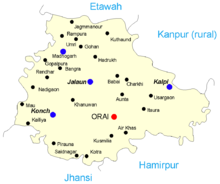
Jalaun
In the early 14th century, the Bundelas occupied the greater part of Jalaun and even succeeded in holding the fortified post of Kalpi.
Akbar's governors at Kalpi maintained a nominal authority over the surrounding district, and the Bundela chiefs were in a state of chronic revolt, which culminated in the war of independence under Maharaja Chhatrasal.
[4] Various interchanges of territory took place, and in 1856 the boundaries of the British district were substantially settled, with an area of 1,477 square miles (3,830 km2).
In the later 19th century, the district suffered much from the invasive kans grass (Saccharum spontaneum), owing to the spread of which many villages were abandoned and their land is thrown out of cultivation.
[1] According to History the British Jalaun in the year 1840 state of the Maratha merger by its territory was taken intact Pargana Orai-Jalaun Aata and Mahoba instructed to own its rights and even received it.
that's why Jalaun is still struggling for basic needs of Railways, Roadways stands, Industrial areas, educational hubs, Good leadership, Employment.
Jalaun Nagar Palika Parishad has total administration over 9,560 houses to which it supplies basic amenities like water and sewerage.
It is also authorize to build roads within Nagar Palika Parishad limits and impose taxes on properties coming under its jurisdiction.