Hamirpur district, Himachal Pradesh
The Katoch dynasty predominated during the period of Raja Hamir Chand, who ruled from 1700 to 1740 and built the fort at Hamirpur The present town derived its name from this ruler.
The River Beas separates Hamirpur from Kangra and is a parent river to two tributaries, namely Maan Khad and Kunah Khad ('Khad' is a word used to describe a rivulet) flowing across either side of Hamirpur district, to the adjacent Sutlej.
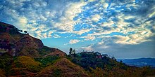
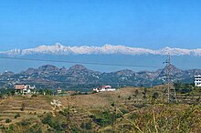
Hamirpur district has a considerable amount of pine forests and it is also surrounded by Shivalik Ranges.
The district has a population density of 407 inhabitants per square kilometre (1,050/sq mi), the highest in the state.
[10] A large proportion of the people in this district serve in the defense services, thus also known as “Veer Bhoomi” (English: Land of the heroes).
[12] Politics in Hamirpur district is dominated by the Indian National Congress and the Bharatiya Janata Party.