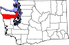
Jefferson County, Washington
[1] The county seat and only incorporated city is Port Townsend.
On April 26, 1854, the legislature of Washington Territory created Clallam County from the northwestern 2,670-square-mile (6,915.3 km2) portion of this original area.
The mountains also block the damp Chinook winds, which make the climate much wetter in the west than the so-called eastern "banana belt" in the rain shadow.
Jefferson County also comprises the entirety of the Port Townsend micropolitan statistical area, which is designated by the U.S. Census Bureau.
As of 2023[update], the county's median age of 60.8 years old is the second-highest among metropolitan and micropolitan areas in the country, behind The Villages, Florida.
[12] In terms of ancestry, 20.8% were English, 20.3% were German, 13.9% were Irish, 8.3% were Norwegian, 5.9% were Scottish, and 4.2% were American.
28.50% of all households were made up of individuals, and 11.70% had someone living alone who was 65 years of age or older.
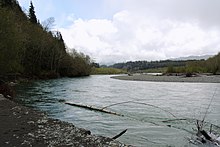
The contrasts are notable as the west portion is more dependent on logging, somewhat less prosperous, and having fewer people for roughly the same area.
Areas of East Jefferson County located south of Port Townsend remain largely rural and can be divided into two parts, those communities located on the Hood Canal and those on the Admiralty Inlet.
Areas outside of Port Townsend (such as Cape George) gave Obama 2-to-1 victory margins.
Democrats also do well in many of the small towns of northern Jefferson County, with strong Democratic leans in Coyle, Discovery Bay, Gardiner, and Nordland, as well as in the towns just southeast of Port Townsend such as Chimacum, Irondale, Kala Point, and Port Hadlock.
The largest private employer in Jefferson County is the Port Townsend Paper Mill.