Jeolla Province
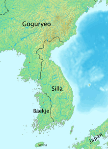
During the Samhan era of Korean history, the area of Jeolla was controlled by the Mahan confederacy and the Tamna kingdom on Jeju.
The northern territory of former Baekje, Ung (Ungju; 熊州), corresponds to modern-day South Chungcheong Province.
The southern area consisted of Mujin (Mujin-ju), which was renamed Mu (武州) in 757, the 16th year of the reign of Gyeongdeok of Silla.
In 995, King Seongjong again reorganized the country, this time into 10 do (Korean: 도; Hanja: 道; lit. province).
Jeollaju-do was variously known as Gwangnam, Jeongwang, and Jeonnam, but the original name persisted, and was eventually shortened to simply Jeolla-do (全羅道).
On May 26, 1895, Gojong of Korea replaced the 8 do system with a 23 bu district system and Jeolla was replaced by the districts of Jeonju (Korean: 전주부; Hanja: 全州府; RR: Jeonjubu) in the northwest, Naju (나주부; 羅州府; Najubu) in the southwest, Namwon (남원부; 南原府; Namwonbu) in the east, and Jeju (제주부; 濟州府; Jejubu) on Jeju-do.
The region is bordered on the east by the Sobaek Mountains and is drained by the Yeongsan, Seomjin and Mangyeong rivers.
Apart from Jeonju and Naju, other cities of note include Iksan (formerly Iri), Gunsan, Mokpo, Namwon, Suncheon, and Yeosu.