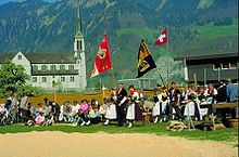
Lungern
It is the highest village of the Sarneraa-Valley, in a basin open only to the north and surrounded on all other sides by steep and woody inclinations and rocks.
On its north-western side, the municipal boundary is set by the Wilerhorn and Höch Gumme mountains, and includes the whole of the Lake of Lungern.
[5] The first legal proof of Lungern's existence is contained in a tax register for the diocese of the bishop of Konstanz in Germany dating from the year 1275.
At the end of the 18th[dubious – discuss] century the population of Lungern lowered the level of the lake, with great effort and over many years, in order to improve living conditions.
Within 80 years the hard-won land was lost to a new dam: in 1922 a company named CKW built and started running a power station located at the lake.
In fact 17.5% of the total population of Lungern are of a pensionable age, compared with an average of 12% in the canton.
Of the rest of the working population, 13% were in commercial business or teaching staff, 12% were self-employed and 11% were domestic and hotel employees.
All of the agricultural farms are cultivated by native highlanders, and they are mainly situated not in the bottom of the valley but on its slopes.
[dubious – discuss] Lungern has a large industrial sector with the main employers being Gasser Felstechnik [Wikidata] with 300 employees specialising in securing rockfaces preventing rockfalls and landslides, neue Holzbau AG[n 1] (70+ employees) specialising in pre-fabricated wooden constructions and engineered wood products, H-P Gasser Membranbau[n 2] (80+ employees) specialising in membrane structures and skylights and Sutter Fahrzeugbau[n 3] who are specialists in coachwork and commercial vehicles.
[11] The main sights of Lungern are: The Brünig railway line passes through the municipality, on its route between Interlaken and Lucerne.