Kemmern
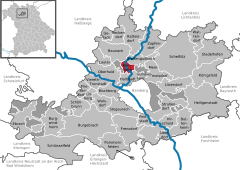
The community of Kemmern is situated at an elevation of approximately 245 meters on the Main River, seven kilometers north of Bamberg at the foot of the Haßberge range.
Kemmern is nestled in an historic cultural landscape with a path system from the High Middle Ages.
Many hiking and cycling paths connect Kemmern to places of interest to visitors (such as the Main Valley, the Haßberge, the Steigerwald [forest], the “Franconian Switzerland” and the world heritage city of Bamberg).
The earlier Bürg may have had Slavic beginnings as an important refuge and worshipping place for the Main Wends.
The first time that Kemmern was mentioned in writing was in a document from 26 October 1017 AD as Camerin in the Radenzgau (a county roughly corresponding to today’s Upper Franconia).
In the centuries that followed up until Secularization in 1803, Kemmern remained an Obleidorf (from Mediaeval Latin oblaia, an old term for things donated to spiritual institutions or monasteries; Dorf is “village” in German) of the Bamberg Cathedral Chapter, but it nevertheless had at its disposal quite early on a definite measure of autonomy.
How much suffering the Thirty Years' War brought Kemmern can be seen in what had happened by 1638 in the cathedral chapter households, of which there were 68, and of which only 26 were still occupied by this time.
Municipal council consists of the directly elected mayor and 14 councillors (9 CSU, 5 UBB, 1 SPD).
The current municipal tax collection rates amount to: According to official statistics, there were 65 workers on the social welfare contribution rolls working in producing businesses in 1998, and in trade and transport 33.