Kerkrade
In 1815, the Congress of Vienna created the current Dutch-German border and divided the town into the Dutch Kerkrade and the Prussian (German) Herzogenrath.
In 1815, when the kingdom of the Netherlands was formed (see Vienna Congress), the border was drawn through Herzogenrath, the western part being Kerkrade.
More modern exploitation by others started in 1860, causing Kerkrade to grow significantly, especially as a consequence of the permanent settlement of mainly Southern-European miners in this Northern-European place.
[6] There was a separate 2-way road on each side, and cars had to pass through the official crossing points, but pedestrians could readily step over the wall (although there were signs informing of the border).
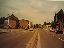
The two towns now share some of their public services,[9] and promote themselves as a binational "City of Eurode" for economic development purposes.
The building of a dam in the Anstel, a brook flowing west of Kerkrade, has led to the formation of a reservoir with an area of about 20 ha.