Kyrenia
While there is evidence showing that the wider region of Kyrenia has been populated before, the city was built by the Greeks named Achaeans from the Peloponnese after the Trojan War (1300 BC).
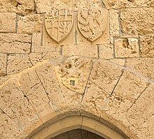
Kyrenia grew in importance after the 9th century due to the safety offered by the castle, and played a pivotal role under the Lusignan rule as the city never capitulated.
While the city suffered little intercommunal violence, its Greek Cypriot inhabitants, numbering around 2,650, fled or were forcefully displaced in the wake of the Turkish invasion in 1974.
It hosts an annual culture and arts festival with hundreds of participating artists and performers and is home to three universities with a student population around 14,000.
The 'Geography' of Claudios Ptolemaios which was lost for over a thousand years and rediscovered in medieval times, is a further important source upon which the later cartography of the Renaissance is based.
The roads are drawn in straight lines and the road-stations are marked by kinks, and towns by pictograms with the name of the place and the numbers in Roman miles.
[10] The earliest reference made to the town of Kyrenia is found, together with that of the other seven city kingdoms of Cyprus, in Egyptian scripts dating from the period of Ramesses III, 1125-1100s BC.
Boats set sail from the Aegean islands, traveled along the Asia Minor coast, and then crossed over the short distance to the northern shores of Cyprus to reach the two city kingdoms of Lapithos and Kyrenia.
This lively maritime activity (late 4th or early 3rd century BC) is evident in an ancient shipwreck discovered by Andreas Kariolou in 1965, just outside Kyrenia harbour.
The vessel's route along Samos, Kos, Rhodes, the Asia Minor coastline and then Kyrenia, demonstrates the town's close maritime relations with other city kingdoms in the eastern Mediterranean.
During the succession struggle between Ptolemy and Antigonus that followed Alexander the Great's death in 323 BC, Kyrenia was subdued under the rule of the kingdom of Lapithos that allied itself with the Antigonid dynasty.
In the 2nd century BC, it is cited as one of six Cypriot towns which were benefactors to the Oracle at Delphi, that is, it received its special representatives who collected contributions and gifts.
Early Christians used the old quarries of Chrysokava, just east of Kyrenia castle, as catacombs and cut-rock cemeteries which are considered among the island's most important specimens of this period.
The Byzantine emperors fortified Kyrenia's Roman castle and in the 10th century, they constructed in its vicinity a church dedicated to Saint George, which the garrison used as a chapel.
The rest of the inhabitants moved further out to the area known as Pano Kyrenia or the 'Riatiko' (so called because it once belonged to a king) or fled further inland and to the mountain villages of Thermeia, Karakoumi, Kazafani, Bellapais and Karmi.
Then in 1856, following the Hatt-i Humayun, which introduced social and political reform and greater religious freedom for the various peoples of the Ottoman Empire, the church of Archangel Michael was rebuilt on a rocky mount overlooking the sea.
Local agriculture and maritime trade, particularly the export of carobs to Asia Minor, allowed the people of Kyrenia to have a comfortable living, and some even to educate their children and pursue other cultural activities.
One explanation for this exodus may be the general anxiety that prevailed among the island's Muslim population during the Balkan and First World wars, when the Ottomans fought against Greece in the former and Britain in the latter.
A road was constructed through the mountain pass to connect the town to Nicosia, the island's capital, and the harbour was repaired and expanded to accommodate increasing trade with the opposite coast.
High taxation, frequent droughts, and a world economic depression were precipitating factors for a mass exodus of people from the town and district, first to Egypt and then to the United States.
The transfer of the island to British rule also prompted anxiety in the Turkish Cypriot population, whose numbers stagnated as a significant emigration to Anatolia took place.
After the Second World War, more hotels were built and the town remained a favoured vacation spot for people from Nicosia and foreign travellers alike.
Other than the many traditional cultural and religious fairs and festivals annually celebrated, flower shows, yachting races, concerts and theater performances were organized.
On 20 July 1974, the Turkish army invaded Cyprus in response to a coup d'état carried out by EOKA B and the Greek military junta of 1967–1974,[19] landing at 5-Mile point, west of Kyrenia.
Larger boats, mostly from Europe, arrived in the late fall and early winter to take in the crop of carobs, the main export item of the area.
The caiques brought in wood, earthenware, legumes, cheese, butter, and even small luxuries items such as silk and cotton cloth, buttons and odd pieces of furniture.
The town's trade with the Anatolian coast and beyond the Levant sea was badly affected when in 1885, the then British government of the island began the Kyrenia harbour works that left the harbor wide open to the northern gales.
[21] The city is also home to four 19th century fountains[22] and an Ottoman-era cemetery where soldiers serving at the castle and victims of contagious diseases are rumoured to have been interred.
However, the recession that struck Northern Cyprus at the end of the 2000s and the beginning of 2010s affected the city and caused great difficulty for the small-scale entrepreneurs and shop owners to maintain their businesses.
This port is a major transport hub in Northern Cyprus due to its relative proximity to Turkey and is home to commercial activity, while being a place of entry for tourists who choose to travel by ferry.