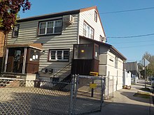
Kew Gardens Hills, Queens
The borders are Flushing Meadows–Corona Park to the west, the Long Island Expressway to the north, Union Turnpike to the south, and Kissena/Parsons Boulevards to the east.
[5] Kew Gardens Hills is situated in the southwestern corner of the area historically known as the Town of Flushing, in its 6th district.
As neighborhoods in the City of New York are not designated by the city,[6] there are multiple means to determine the geographical boundaries of the area: Adjacent neighborhoods include Forest Hills to the west, Hillcrest and Pomonok to the east, Briarwood to the south, and Queensboro Hill to the north.
By 1762 the farm was owned by Colonel Thomas Willet, High Sheriff of Flushing,[18] and was sold to Cadwallader Colden, lieutenant governor for the Province of New York.
[20] Timothy Jackson operated a horse boarding stable near where the intersection of Park Drive East and Union Turnpike, or the Kew Gardens Interchange is today.
This area was an extension of Timothy Jackson's Willow Glen Farm for which the farmhouse was located south of Union Turnpike in the neighborhood of Jamaica that is now called Briarwood.
Missy's body was found the same day in a vacant lot on 71st Avenue at 162nd Street (the area where the 107th Precinct is located today.)
[34] On September 16, 2010, an EF1 tornado touched down in Flushing Meadows–Corona Park, causing widespread damage to cars and homes in the Kew Gardens Hills area.
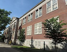
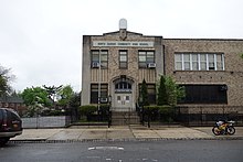
John Bowne High School—located along Main Street at the edge of the CUNY Queens College campus, directly across from Mt.
[35] Based on data from the 2010 United States Census, the population of Kew Gardens Hills was 37,479, an increase of 1,427 (4.0%) from the 36,052 counted in 2000.
[39] In 2018, an estimated 22% of Kew Gardens Hills residents lived in poverty, compared to 19% in all of Queens and 20% in all of New York City.
Based on this calculation, as of 2018[update], Kew Gardens Hills is considered to be high-income relative to the rest of the city and not gentrifying.
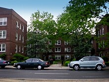
[40] The neighborhood contains an established Orthodox Jewish population and some Israelis and Bukharan Jews, as well as smaller groups of Latinos, Koreans, Chinese, Indians, Afghans and African Americans.
[42] Congregation Machzikei Hadas formed by Rabbi Yosef Gelernter on 73rd Avenue, is home to the first mikveh in Kew Gardens Hills.
[43] In March 1960, the City Council named a small park at Vleigh Place and Main Street as Freedom Square to commemorate the one hundredth anniversary of the birth of Theodor Herzl, founder of present-day Zionism.
[28][44] The Yeshivas Chafetz Chaim,[45] Ohr Hachaim[46] and Kesser Torah[47] are situated in Kew Gardens Hills.
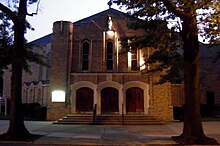
[49] Other houses of worship include the Roman Catholic Church Queen of Peace, located on Main Street at 77th Road.
Kew Gardens Hills generally has a higher ratio of college-educated residents than the rest of the city as of 2018[update].
[50] Kew Gardens Hills' rate of elementary school student absenteeism is less than the rest of New York City.
[38]: 24 (PDF p. 55) [37]: 6 Additionally, 86% of high school students in Kew Gardens Hills graduate on time, more than the citywide average of 75%.
Queens College also serves as an important cultural institution for neighborhood residents with Colden Center for the Performing Arts and the Godwin-Ternbach Museum.
[25] Notable graduates of Queens College include native son Jerry Seinfeld, who was awarded an honorary doctorate in 1994, Ron Jeremy,[65] and Paul Simon.
Queens Public Library operates the Kew Gardens Hills Branch at 72-33 Vleigh Place.
[67] In 2012, the section of Vleigh Place between 72nd Drive and 72nd Road, the block of the library building, was renamed Pat Dolan Way.
[66] Queens Public Library also operates the nearby Pomonok Branch at 158-21 Jewel Avenue, east of Parsons Boulevard.
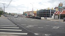
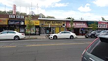
Many of the businesses along Main Street in Kew Gardens Hills close for Shabbat due to the area's large Jewish population.
[74] Kew Gardens Hills is served by the New York City Fire Department (FDNY)'s Engine Co. 315/Ladder Co. 125, located at 159-06 Union Turnpike.
[37]: 14 The concentration of fine particulate matter, the deadliest type of air pollutant, in Kew Gardens Hills is 0.0078 milligrams per cubic metre (7.8×10⁻⁹ oz/cu ft), lower than the citywide and boroughwide averages.
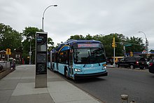
[78] The entire area of Kew Gardens Hills is part of New York City Council District 24, represented by Jim Gennaro.
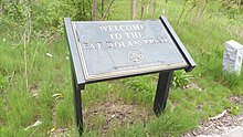
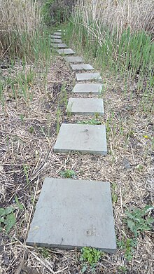
[81] Residents were formerly able to access Kew Gardens–Union Turnpike station by foot via the Pat Dolan trail through Flushing Meadows-Corona Park.