Kilflynn
A popularised tale[3][4] is that it was named after a Roman Catholic hermit monk, Flainn, said to have lived by the River Shannow (which runs through Kilflynn).
Welsh cantref or English hundred) or rural deanery of Othorna & Oflannan (Irish Uí Thorna & Uí Flannáin) was an Anglo-Norman sub-division, in this case generally along the historical boundaries of much older kingdoms and regions which were part of West Munster (Irish Iarmuman or Iar Mbumba), in the realm of the Ciarraighe, and which later became County Kerry some time between 1222 and 1229.
The rocks underlying the village area are typically Namurian sandstone and shale[14] which formed between 326 and 313 million years ago during the Carboniferous period and cover 27% of County Kerry.
The centre of Kilflynn is actually on the edge of this area.Immediately to the north and west the bedrock is limestone (later to be sourced from nearby Lixnaw and Abbeydorney for use in lime kilns).
These rocks, as part of the Western Irish Namurian Basin (or Clare Basin) were formed in a sub-equatorial tropical environment, due to the deposition of fine particles in a delta, likely from a river flow to the south-west on a continental mass formed from what are now North America, Eastern Europe, Western Europe and Africa.
The glacial meltwater evidence coincides with an area to the south and east of Kilflynn and the N26 road, broadly in line with the edge of the hills facing the north-west.
The ice sheet that covered Ireland split about 19,000 years ago, along a corridor that included the area where Kilflynn lies and going down past Banna Strand (the sea level was lower then) towards the Atlantic.
As with most of the West of Ireland, the weather of the area is strongly affected by the North Atlantic drift and the prevailing south-westerly winds.
Being 10 km inland and well beyond the hills to the south-west, Kilflynn is somewhat sheltered from extremes of wind speed and precipitation experienced largely in the south and west of County Kerry.
[17][18] For agriculture and horticulture, the last spring air frost is typically in late March or April, that is to say about five to six weeks later than coastal areas (on exposed land).
Up until the 1980s, there were eels and fish such as brown trout to be found in the river up at least as far as the Waterfall (where the N69 crosses), with birdlife such as various types of finch, dippers and what are locally called 'cranes' (grey herons, which were caught and eaten historically).
Kerry County Council, which expects a modest increase in population, has made plans for updated local water treatment, improvements for pedestrians and cyclists, and supporting repopulation with associated services, also commenting on Kilflynn as a choice for commuters [into Tralee and Listowel] while impressing the need to retain its peaceful character.
[23] The late Neolithic Beaker folk introduced their cultural advances possibly from the Low Countries or from Iberia; this resulted in key changes and Irish becoming a unique Celtic language.
Recent evidence shows a huge number of Irish men have the R1b DNA marker with similarly high percentages also found in other modern Celtic areas on the European Atlantic coast, including the Basque region.
In 2011, archaeologists working on the site of the realignment of the N69 Tralee-Listowel road found evidence for early Bronze Age and mediaeval activity in the townlands of Gortclohy and Cloonnafinneela.
A second dig at Cloonafinneela gave up evidence of various plants as burnt roofing thatch including rushes, cereals, hazel, oak and willow charcoal, the hazel dated to between 1450 and 1635 A.D.[26] Kilflynn is in the middle of the area settled in the first century by the Ciarraighe (also Ciarraigh or Ciarraidh], the mediaeval tribe (from which the county name Kerry is derived) and claimed descendants of Ciar the son of the mythological queen Medb of Connacht and one of her lovers, king Fergus mac Róich of Ulster.
[27][28] Prior to this the Velabri[29] around Kerry Head and further south the Iverni people (or Iernoi from the earlier Greek) were noted by Ptolemy to be concentrated in the south-west area of Ireland, speaking the most primitive Goidelic language similar to Gaulish (as recorded on Ogham stones, with examples found close by in Knockbrack and Tralee, from the 6th Century).
This barony developed from the area which had been in the control of native leaders (especially O'Conors)[32] but was taken over by the Norman, Maurice, son of Thomas FitzGerald of Shanid who died in 1213.
[46][47] However, there was also from the 1840s onwards the significant effect of the peak years of the Great Famine in which between 20% and 30% of the population of Kerry died or emigrated (see map).
The Kilflynn company of the Irish Volunteers was formed in 1913 of about 100 men, drilled by two ex-British soldiers and reservists named Collins and Sheehy.
Later in 1914, the reservists were called up to fight in what became World War I and in addition John Redmond encouraged the Irish to join the Allied forces, so the company disbanded as a result and didn't reform until 1917 at Lixnaw.
In recent decades, especially in the surrounding farmland, migration of youth for better financial prospects has kept a smaller, ageing population present, as is typically reflected elsewhere in rural villages of Ireland.
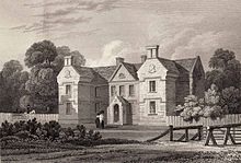
[59] The latter contains the life story of the major local historical figure of note, Horatio Herbert Kitchener, Earl of Khartoum, the former British Field Marshal and Secretary of State for War, who was born in Ballylongford and spent most of his youth at nearby Crotta House.