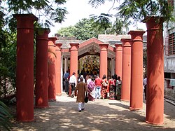
Kolkata district
During seventeenth century Sutanuti was a major wool-trading center where had flourished the Basak, Sett, and a group of Portuguese merchants.
[5] With the decline of the once flourishing Saptagram port, traders and businessmen, such as the Basaks, the Sheths and others, started venturing southwards and settled in or developed places such as Gobindapur.
While both Sutanuti and Gobindapur appear on old maps like Thomas Bowrey's of 1687 and George Herron's of 1690, Kalikata, situated between the two, is not depicted.
[6][7][8] Around early March 1698, the East India Company (EIC) proposed to the Roy Choudhurys that Dihi Kalikata be subrented to them.
[9][10] This led the EIC to negotiate for the rent-rights outright and at the Mughal quarters; one Nathaniel Walsh was dispatched to Prince Azim-ush-Shan, then-Viceroy of Bengal Subah.
[9] The zamindari rights, for Dihi Kalikata, Sutanuti and Govindapur, had been transferred to the Company paying Choudhury total of 2000 Rupees.
[12] Subsequent to the fall of Siraj-ud-daulah, the last independent Nawab of Bengal, the English purchased 55 villages in 1758 from Mir Jafar.
In 1772, Kolkata became the capital of East India Company's territories, and in 1793, the English took full control of the city and the province.
Development of Kolkata's infrastructure started and in the early 19th century, the marshes surrounding the city were drained.
With the experience and memories of the Bengal famine of 1943, the Great Calcutta Killings, the final partition of Bengal, and independence of the country, Kolkata moved on to a new era of challenges, with millions of refugees pouring in from neighbouring East Pakistan (later Bangladesh).
After partition of Bengal, the number of refugees moving in from East Bengal were so high that large stretches of rural or semi urban habitation were transformed into towns, the density of population, particularly in areas with high refugee population, jumped by leaps.
In 1975, a CMDA report suggested that there were 1,104 squatter colonies in West Bengal, out of which 510 were in Calcutta Metropolitan District.
Right form the 16th century, a number of townships, based on trade and commerce, had sprung up along both banks of the Hooghly.
The promise of a better quality of life may have been an initial attraction for the migrants, but bulk of the poorer sections soon realized that poverty in Kolkata was as severe and dehumanising as in the villages they left behind.
A 1976 survey revealed that the proportion of workers from outside West Bengal were 71% in the jute industry, 58% in textile mills and 73% in iron and steel units.
"[19] P. Thankappan Nair writes, “The six square miles within the Maratha Ditch (the original core of Calcutta) thus came to have the world’s highest density of population in that age.
It was a heterogeneous population, sinking differences of caste, creed and colour under the sheer compulsion to interact and survive together.
It has kept growing and living by the ever-renewed confidence and vitality of its inherent human forces.”[20] Kolkata district lies between 22.037’ and 22.030’ North latitude and 88.023’ and 88.018’ East longitude.
[24] According to the 2011 census Kolkata district has a population of 4,496,694,[26] roughly equal to the nation of Croatia[27] or the US state of Louisiana.
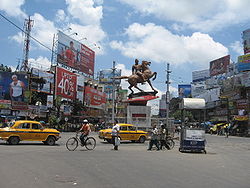
The switching over from horse-drawn carriages to electricity by Calcutta Tramways Company in 1902, provided further impetus to the rise in power consumption.
[39] As per KMC, it has 5 water treatment plants at Palta, Watgunge, Jorabagan, Dhapa and Garden Reach.
William Tolly tried to develop an eastward drainage-cum-communication channel by excavating the almost dead bed of the Adi Ganga.
Some of the other channels were; Beliaghata Canal (1800), Circular Canal from Entally to Hooghly river (1820), Bhangor Khal (1897–98) and the 16 km long Krishnapur Khal, a navigational channel connecting Kolkata with Nona-Gang-Kulti Gang in South 24 Parganas (1910).
With these handicaps, the smoke from vehicles and industrial units, coupled with winter fogs, create a polluted environment.
[46] The East India Company secured the license for trading in Bengal from the Mughal emperor Aurangzeb.
By the turn of the century more Marwari families were in the business limelight: the Poddars, the Mundhras, the Dalmias, the Dugars, the Jalans, the Jhunjhunwalas, the Jaipurias, the Rampurias and the Birlas.
[47]Burrabazar became a stronghold of Marwari businessmen from the middle of the 19th century but their operations remained subservient to British business interests.
Business opportunities during World War I transformed the Marwaris from a trading community to entrepreneurs and they started challenging the British economically.
After World War II, as the British left India, the Marwaris acquired most of their business interests.
With political ‘delinquency’ prevailing in Kolkata from the sixties many Marwaris, particularly the elite, started looking for greener pastures elsewhere.