Kourion
The Kourion archaeological area lies within the British Overseas Territory of Akrotiri and Dhekelia and is managed by the Cyprus Department of Antiquity.
The earliest identified occupation within the Kouris River valley is at the hilltop settlement of Sotira-Teppes, located 9 km northwest of Kourion.
Episkopi-Bamboula, located on a low hill 0.4 km west of the Kouris and east of Episkopi, was an influential urban centre from the LC IA-LCIII.
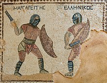
In the first to third centuries, epigraphic evidence attests a thriving elite at Kourion, as indicated by a floruit of honorific decrees (Mitford No.84, p. 153) and dedications, particularly in honour of the emperor, civic officials and provincial proconsuls.
In the later-4th century (365-370), Kourion was hit by five strong earthquakes within a period of eighty years, as attested by the archaeological remains throughout the site, presumably suffering near-complete destruction.
In 1874–5, Luigi Palma di Cesnola, then American and Russian consul to the Ottoman government of Cyprus, extensively dug at the cemetery of Ayios Ermoyenis and the Sanctuary of Apollo Hylates.
[20] Between 1882 and 1887 several unauthorized private excavations were conducted prior to their illegalization by British High Commissioner, Henry Ernest Gascoyne Bulwer in 1887.
Megaw returned to work on the site, on behalf of Dumbarton Oaks Centre for Byzantine Studies, from 1974 to 1979 at the Early Christian Basilica.
[35][36][37] Since 2012, the Kourion Urban Space Project, under director Thomas W. Davis of the Lanier Center for Archaeology at Lipscomb University in Nashville, TN, has excavated on the acropolis.
The earliest archaeological evidence for the sanctuary are from votive deposits of the late eighth century BC located in the southern court and at the archaic altar.
North of the priests residence and south of temple are the remains of an archaic altar, the earliest structure at the sanctuary dating to the late-eighth or early seventh-century AD.
A structure of the late-fourth century BC, located east of the later sacred way, and south of the altar served as the residence of the priests of Apollo and the temple treasury.
The temple was subsequently abandoned after a period of decline in the late fourth century AD, after it was sustained significant damage in an earthquake.
Additional Hellenistic remains were uncovered in 1948/49 by the University of Pennsylvania Museum Expedition immediately east of the Complex of Eustolios in the form of black and white pebble mosaic.
The theatre was initially constructed on a smaller scale in the late-second century BCE on the northern slope of the defile ascending from the Amathus Gate.
The theatre's scene building was seemingly reconstructed in 64/65 CE by Quintus Iulius Cordus, the proconsul, and it was likely at this time the ends of the cavea were removed, reducing it to a Roman plan of 180 degrees.
The House of Achilles is located at the northwestern extent of the acropolis, at the southern end of a saddle connecting the acropoline promontory to the hills to the north and west.
Constructed in the early fourth century CE, it has been interpreted as an apantitirion, or a public reception hall for imperial and provincial dignitaries.
The most important of these mosaic depicts the unveiling of Achilles's identity by Odysseus in the court of Lycomedes of Skyros when his mother, Thetis, had hidden him there amongst the women so that he might not be sent to war against the Trojans.
[48] Its destruction in the earthquakes of the late fourth century, and the absence of rebuilding in this area of the city subsequently provides a dramatic view on non-elite life at Kourion.
The forum, the centre of public life, consisted of a central pavement with colonnaded porticoes set along its east, north and western sides.
The eastern portico measured 65 m in length and 4.5 m wide, with a colonnade facing the courtyard, and a wall forming frontage of shops to the west.
The stadia at Kourion was 187 m long with a starting line marked by two circular stone posts, set wide enough to accommodate eight runners.
A mosaic inscription in the eastern portico identifies the building as Eustolios, who built the structure to alleviate the suffering of the populace of Kourion, presumably in response to the earthquakes of the mid-to-late 4th century.
The accompanying iconography includes figural depictions of fish and birds (grey goose, guinea hen, falcon, partridge and pheasant).
The cathedral and episcopal precinct of Kourion, located along the crest of the cliffs immediately southwest of the forum, was constructed at the beginning of the fifth-century and renovated successively in the sixth century.
thumb|The Diakoinon in the Basilica The precinct was constructed at the end of the fourth and very beginning of the fifth centuries CE, a time in which Kourion was recovering from the devastation of the earthquakes of 365/370.
The allocation of such resources to this basilica, as well as the concurrent abandonment of the Sanctuary of Apollo Hylates, indicates the centrality Christianity had assumed to the city's religious institutions.
The central apse possessed a synthronon for the clergy, with the chancel set apart from the nave by marble screens and an opus sectile pavement.
In the early-6th century, an early Christian basilica was constructed at the base of the southwestern bluffs, below the acropolis, near the western extent of the unexcavated harbor area.