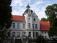
Lübbecke
Between the wet lowlands south of the Mittelland Canal, the glacial valley of the River Weser and the higher ground is a narrow fringe of fertile loess soils at the foot of the Wiehen Hills called the Lübbecker Lößland.
Geologically, the surface is mainly covered with unconsolidated rock of the Quaternary period i.e. sand, gravel, loess and glacial till, predominantly from the Pleistocene epoch.
Of particular importance, today as in the past, is the recovery of limestone for use as ballast for buildings and roads, and there is a large working quarry in the Wiehen Hills, south of Nettelstedt, where rock is broken and crushed.
Old transport systems (using tipplers) still existed until a few years ago, when production stopped due to the exhaustion of the deposits and for reasons of nature conservation.
The following table gives an overview of its land usage: Source: LDS[4] The most densely populated areas are the fertile foothills, known as the Lübbecke Loessland (Lübbecker Lößland); this is where almost all the villages are found.
In some places the frugal green maize crop still grows albeit requiring heavy supplies of manure.
Within the protected area of the peat bog, but still outside of the actual moor, there is some extensive grazing, especially of sheep, almost exclusively for environmental grounds.
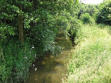
Apart from the larger woods in Lübbecke Land beyond the town limits, there are only small copses in the lowlands which together comprise less than 1 square kilometre (0.4 sq mi).
Inter alia These are the Stockhauser Busch, small copses in the area of the marina and the birch woods on the Großer Torfmoor.
On the border of the town to the north-west at Alswede on the territory of Preußisch Oldendorf is the approximately 44 hectare Hollwinkel Wood.
The winters, influenced by the Atlantic, are generally mild, the summers moderately warm, and its precipitation spread relatively evenly throughout the year.
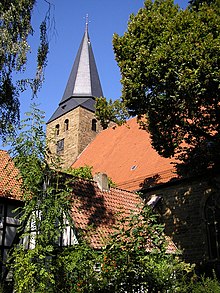
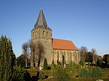
In those days there may already have been a church in hlidbeki that dated back to the Saxon Angrivarii under their duke, Widukind, a tribe who had settled the region during the spread of Christianity under Charlemagne.
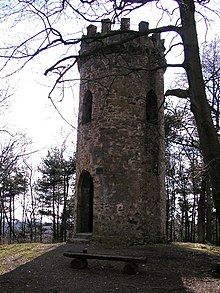
Due to the high cost of maintenance and their limited military value, the fortifications were razed in 1830 and the material used for construction, the walls being transformed into promenades.
The town hall regulations adopted in 1727 by the Prussian government institutionalized this 'diarchy' and envisaged only two senatorial seats.
Like almost everywhere in Minden-Ravensberg the textile industry initially emerged in proto-industrial form and, later, was supported by the Prussian state with the construction of the Cologne-Minden Railway and its branch line from Bünde to Rahden, opened in 1899.
The cigar industry developed into an important economic factor in Bünde Land and the surrounding towns, including Lübbecke, from about 1860.
This included employees in its many branches, because just as before in the proto-industrial textile sector, cigars were often cut, rolled and pressed in the home or in stalls.
In 1899 the Gasfabrik am Hahlerbaum, a local gas company, was founded; the precursor to today's public utilities.
In the Second World War, Lübbecke largely escaped attack and was occupied on 3 April 1945 by British troops without great resistance.
Up on the hillside above the town was a former Hitler Youth training centre that was also commandeered after the war as Montgomery's headquarters and later became the Officers Mess for HQ 2nd Armoured Division until 1983.
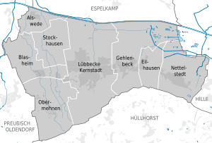
At the same time the borough of Lübbecke was significantly increased in size by the parishes of Blasheim, Gehlenbeck, Eilhausen and Nettelstedt and the farming community (Bauernschaft) of Alswede.
¹ Census results (measured against the current boundaries) Before the municipal and land reforms that took place on 1 January 1973 the present villages formed their own parishes in Amt Gehlenbeck (Nettelstedt, Eilhausen, Gehlenbeck) or were farming communities (Bauernschaften) attached to parishes (Obermehnen, Blasheim, Stockhausen and Alswede).
In the south Lübbecke was given part of the Wiehen Hills (Amt Hüllhorst) that used to belong to Ahlsen-Reineberg, namely the Reineberg and the northern slopes of the Heidbrink.
The idea came from the workers of the numerous cigar factories of that time, who often sang songs at work and wanted to form a society around their pastime.
As a small town situated between moorland and forest, Lübbecke has no need for expansive parks in the classic sense.
Another large, local area of grassland with walks is located between the cemetery and the Wittekind Grammar School (Wittekind-Gymnasium).
Significantly, all the aforementioned parks and open spaces are within range of the more select residential areas, which are anyway in the immediate vicinity of the Wiehen Hills.
The wildlife in Lübbecke includes the following large animals in the near-natural forested and moorland areas: wild boar and roe deer, fox, badger especially in the Wiehen, but also on cultivated land.
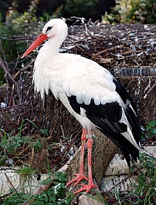
Lübbecke is one of only two places, the other being nearby Petershagen, in the state of North Rhine-Westphalia where wild white storks still breed.
[13] There are serious discussions that Lübbecke, possibly in cooperation with the neighbouring town of Espelkamp, will apply to stage the state garden show in 2017.