Metairie, Louisiana
Metairie (/ˈmɛtəri/ MET-ər-ee) is an unincorporated community and census-designated place (CDP) in Jefferson Parish, Louisiana, United States, and is part of the New Orleans metropolitan area.
With a population of 143,507 in 2020,[2] Metairie is the largest community in Jefferson Parish and was (as of 2010) the fifth-largest CDP in the United States.
In the 1760s many of the original French farmers were tenants; after the Civil War, the majority of the community's inhabitants were sharecroppers until urbanization started in the 1910s.
[citation needed] An electric streetcar was installed running along Metairie Road in the late 1910s, opening the area to greater development.
[citation needed] The land between Metairie Ridge and Lake Pontchartrain, which was cypress swamps and marshlands, was drained with the Wood Pump.
[citation needed] The 1947 Fort Lauderdale hurricane, with winds of 125 mph (201 km/h), directly hit Metairie.
[9] Hurricane Betsy, a Category Three storm, hit the area in 1965, causing extensive wind damage and moderate flooding.
[10] In 1995 the May 8th 1995 Louisiana flood, which dumped upwards of 20 inches (510 mm) of rain into Metairie in a twelve-hour period, also flooded some parts of the region, especially areas south and west of Metairie, including Kenner, Harahan, and River Ridge.
[11] In 1989, a Metairie district elected white supremacist David Duke to the Louisiana state legislature for a single term.
[12] On August 29, 2005, Hurricane Katrina caused a new migration from Orleans Parish, because housing was needed to replace what had been destroyed in the flooding of the city.
[citation needed] It has been a racially neutral migration, with equal numbers of black and white residents moving to Jefferson Parish.
[citation needed] Veterans Boulevard was laid out alongside a drainage canal, and became a commercial center of the region.
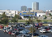
[citation needed] Metairie is located in eastern Jefferson Parish and is bordered by New Orleans to the east, Kenner to the west, Lake Pontchartrain to the north, and the Illinois Central Railroad tracks to the south.
Due to Spanish and French colonial influence, Metairie and the surrounding area have an overwhelmingly Catholic populace.
Approximately 34.6% identify with the Catholic Church, served by the Roman Catholic Archdiocese of New Orleans; 5.9% were Baptist, 3.1% Pentecostal, 1.4% Methodist, 0.6% Lutheran, 0.6% Latter-Day Saints, 0.5% Anglican, and 0.5% from another Christian group including the Metropolitan Community Church among others.
[36] Approximately 0.7% were Muslims and 0.4% identified with an Eastern religion such as Hinduism, Buddhism, or Sikhism;[36] 0.6% of the community claimed affiliation with Judaism.
For many of the major east–west roadways, the eastbound and westbound lanes are separated by large, open-topped drainage canals.