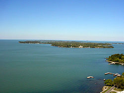
List of Lake Erie Islands
Some small airports and numerous private marinas offer other ways for visitors to reach the islands.
Combined with nearby Sandusky and Port Clinton, Ohio, the islands are part of the collective area known regionally as "Vacationland".
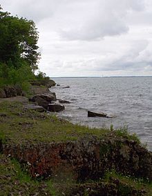
When the Pleistocene ice sheets carved out the basin of modern-day Lake Erie, these hard rocks proved more resistant to erosion than the shales in the east, and as a result, Lake Erie's western end is much shallower than the basins in the east, so that the islands remain above water.
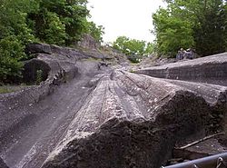
Quarrying operations on Kelleys Island revealed glacial grooves in the bedrock, which would in time be regarded as some of the best direct evidence of the Pleistocene ice sheets available anywhere.
Put-in-Bay Township Port Authority operates public airports for Middle, North and South Bass Islands.