Lake Murray (South Carolina)
[2] In addition to serving as a source of hydroelectric power for the region, the lake has become a recreational attraction, with fishing and boating being popular activities.
For reasons unclear, the Saluda tribe migrated to Pennsylvania beginning in the early 18th century and were replaced by Cherokee from the north.
Because of this common nationality and language, the Dutch Fork community remained very cohesive and somewhat isolated through the years.
Today, the surnames of area reflect this: Sligh, Bickley, Cannon, Drafts, Lindler, Amick, Corley, Shealy, Sease, Bouknight, Bowers, Rikard, Kinard, Koon, Summer, Wise, Dreher, Derrick, Dominic, Geiger, Epting, Frick, Huffstetler, Oxner, Wessinger, etc.
During the American Revolution, the Dutch Fork area was mostly patriot, unlike the surrounding regions that held large groups of English settlers.
The only major engagement of the Revolution that was fought in the vicinity occurred in the nearby town of Ninety-Six, located up the Saluda River.
Many of them had been pressed into the service and brought to the Colonies against their will, and therefore many deserted the army and found shelter in German settlements such as the Dutch Fork.
Today, many locals know of specific ancestors that were brought to fight the young United States and became citizens.
When South Carolina became the first state to secede from the Union, numerous volunteer regiments were created entirely from people in these settlements.
As the demand for electricity in the developing Southern United States increased, it became apparent that harnessing the flow of large rivers such as the Saluda would be needed.
The company acquired the flowage rights on the Saluda River from Dreher Shoals to 20 miles (32 km) upstream.
However, in 1907 the company sold the lands necessary for construction of the lower dam at Dreher Shoals to James W. Jackson, of Augusta, Georgia and W. T. Van Brunt of New York.
[2] Since 1916, a man named Thomas Clay Williams had been proposing the development of hydroelectric power on the Saluda, Santee and Cooper rivers in South Carolina, but his propositions did not generate much serious interest.
In 1920, Congress authorized Murray to head a study undertaken by the United States Geological Survey for the establishment of a large-scale electric power grid in the industrial northeast.
It was said that here, as Murray looked over a topographic map of the Saluda River Valley, his eyes glanced at the 360-foot (110 m) contour line.
[2] While in South Carolina conducting his survey, Murray envisioned a system much larger than Williams's plan for one dam on the Santee River.
The work of acquiring land was made more difficult because many properties had passed from fathers to sons with no legal transfer, with certain lands conveyed under crown grants from King James II of England, and other tracts were heir properties or had no written records.
In general, the landowners and local officials showed a positive spirit of cooperation with Williams and a large number of landowners took up lands adjacent to, or in the vicinity of the project, and continued farming or other pursuits in the same general neighborhood, so that their removal from the valley was not a loss to the community.
Clearing of the woodland up to the 360-foot (110 m) elevation line, which would later become the high-water mark, was completed in the summer of 1928, when 2,000 men were employed and 37 saw mills were operating.
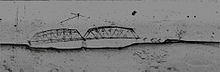
[2] Throughout the 1940s, a number of B-25 Mitchell bombers (flying out of nearby Columbia) crashed into Lake Murray during training exercises for World War II.