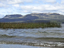
Lake Tarawera
[4] Lake Tarawera is 298 m (978 ft) above sea level,[3][2]: 24 and has a surface area of 41 km2 (16 sq mi).
This includes Lake Tarawera's immediate catchment, being 143.8 km2 (55.5 sq mi) in area, and the catchment of the nearby higher lakes, being a total of 380.9 km2 (147.1 sq mi), with an estimated mean annual precipitation of 20,001 L/s (706.3 cu ft/s).
An estimate has been made of total inflows both surface and subsurface from the surrounding lake catchments[2]: 68–69 The main hot water sources are in the southern section of the lake at the Wairua Stream, Hot Water Beach and Te Puha and Tarawera fumaroles.
[9] Lake Tarawera's outflow at its north east end, has been heavily influenced by the local geology, with a mean 7 m3/s (250 cu ft/s) discharged on the surface into the Tarawera River, which flows north-east into the Bay of Plenty.
[8]: 491–2, 4 The eruption killed over 120 people, and buried the Māori village of Te Wairoa on the southwest shore of the lake.
[11][12] The last major decrease in lake level occurred in a flood of 1904 down the Tarawera River valley after the new volcanic material dam first broke on 1 November 1904.
This rate can be estimated to have been about 1.5 m (4 ft 11 in) in 100 years from the nearest NZ Geonet station RGTA data which has been operative since November 2007 and shows a linear trend in height decrease since then.
[15]: 26 However, in February 2011 a team mapping the lake floor discovered what appeared to be part of the Pink Terraces.
[20]: 34 Lake Tarawera is classified as mesotrophic, with a trophic level index of 3.0 in 2014 which was a decline.
[22] There are multiple popular walking trails with access to thermal features and rock paintings, often without a permit.
[21] The township on the shores of Lake Tarawera is described by Statistics New Zealand as a rural settlement, and covers 4.50 km2 (1.74 sq mi).