Lake Winnipegosis
[1] It appears as Winipgassish on the Fidler map of 1820, while modern spelling dates from as early as 1811.
[1] Lake Winnipegosis is separated from Cedar Lake by a 6 km (3.7 miles) wide (minimum width) land barrier at the north end and from Lake Manitoba by a 3 km (1.9 miles) wide (minimum width) land barrier at the southeast end at Meadow Portage.
The island, located near the middle of the lake, is part of Birch Island Provincial Park, created in 2010, and is adjacent to the Chitek Lake Park Reserve on the eastern shore.
[5][6] The communities of Winnipegosis, Camperville, Pine Creek, Duck Bay, Salt Point and Meadow Portage are south of Birch Island while Shoal River, Pelican Rapids, Dawson Bay and Denbeigh Point are to the north of the island.
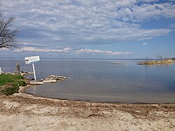
[5] The lake supports a commercial fishery of walleye and other freshwater species.