Leiningerland
Its area coincides with large parts of the collective municipalities of Hettenleidelheim and Grünstadt-Land as well as the town of Grünstadt.
the Leiningerland extends from the northeastern foothills of the Palatine Forest in the west across the northern part of the German Wine Road near Grünstadt to Dirmstein in the east, where the vineyards spread out into the Upper Rhine Plain.
In the Middle Ages, the Eckbach stream was called the Leinbach, which referred to the so-called Leinbaum or Norway maple.
The most important lords in the area until the Early Modern Era, apart from the Leiningens, were the electors of the Palatinate and the prince-bishops of Worms.
French troops caused great destruction under General Mélac during the War of the Palatine Succession (1689–1697).
The Leiningerland was also heavily influenced by Bavarian rule of the Palatinate, which lasted from 1816 to the end of the Second World War.
It was built from 1742 to 1746 by Franz Rothermel to modified plans from the famous church architect, Balthasar Neumann, as a simultaneum.
From a hydro-engineering perspective the 20-Pipe Well of Altleiningen is important; it is fed from a mine gallery which was driven deep into the rock around 1600 in order to supply the castle.
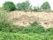
Its main attractions are the 6 hectare reservoir of the Eiswoog, the bridges of the regional Eis Valley Railway, the local Stumpfwald Railway, which is a narrow gauge, heritage line that carries tourists through the forest, and, near Eisenberg, archaeological site of a Roman vicus and the protected landscape of Erdekaut.
Every year, the Wine Countess of the Leiningerland is selected, who then represents the region at events and festivals in the next twelve months.