List of bridges in Hamburg
Besides the Hanseatic city's mercantile and maritime history, the many rivers, canals and bridges lend to Hamburg's claim as the "Venice of the North".
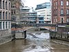
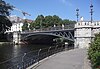
Given the city's waterborne geography and the port's heavy duty requirements, bridges in Hamburg also cover a great variety of architectural styles and innovative structural systems.
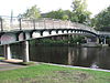
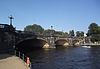
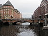
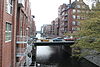
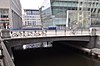
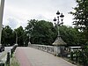
Most of the bridges across the Upper Alster and adjoining canals were first built in conjunction with the area's extensive residential developments from the 1860s onwards.
During Napoleon's brief annexion of Hamburg, a 4 kilometers (2.5 miles) long pile bridge was built across the islands of Wilhelmsburg, however it also required cable ferries across the Elbe's two anabranches.
By the 1840s, with industrialization rapidly growing and trade through the Port of Hamburg skyrocketing, the need for a fixed crossing became apparent.
At the time, the German states were a loose confederation of sovereign states, with the Free and Hanseatic City of Hamburg only controlling the northern Elbe shore, while the town of Harburg and the southern Elbe shore were part of the Kingdom of Hanover.
One of the biggest obstacles was Hanover's rivalry to Hamburg and her attempts to promote overseas trade through the Port of Harburg.
Also starting in 1866, the port's infrastructure was substantially re-organized, in order to cope with the increased quantity of processed goods and to meet requirements of then commonly employed steam-powered vessels.
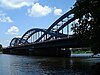
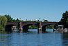
In 1887, the Neue Elbbrücke with its three lenticular trusses (each 102 meters long) became a Hamburg landmark and the first road bridge to cross the Norderelbe, serving many of the port's businesses.
[3] With the Elbe bridges being perceived as a symbol of the many changes associated with the Industrial Age, they were continuously subject to artistic and intellectual reception, among others by artists of the Hamburg Secession (Sezession) during the interwar period, or latest by the Internationale Bauausstellung during the 2000s.


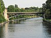


Rivers and canals joining from the left are: Osterbekkanal at Langer Zug, and Mundsburger Kanal at the Außenalster's greatest width.


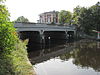
Neue Freihafenbrücke and Köhlbrandbrücke are the last bridges on the respective riverarm, and also the Elbe's last bridges before reaching the North Sea . Only subsequent river crossings are the Old Elbe Tunnel in St. Pauli and the Bundesautobahn 7 's New Elbe Tunnel west of Altona .