List of hillforts and ancient settlements in Somerset
[3] The construction of hillforts began in Britain in the Late Bronze and Early Iron Age, roughly the start of the first millennium BC.
Deposits of iron ore were separated from the sources of tin and copper necessary to make bronze, and as a result trading patterns shifted and the old elites lost their economic and social status.
They would be functional as defensive strongholds when there were tensions and undoubtedly some of them were attacked and destroyed, but this was not the only, or even the most significant, factor in their construction".
[9] Iron Age sites on the Quantock Hills, include major hillforts at Dowsborough and Ruborough, as well as smaller earthwork enclosures, such as Trendle Ring, Elworthy Barrows and Plainsfield Camp.
In addition to the hillforts, several sites have been identified as settlements during the pre Roman period including Cambria Farm and the "Lake Villages" at Meare and Glastonbury which were built on a morass, on an artificial foundation of timber filled with brushwood, bracken, rubble and clay.
In the United Kingdom, a Scheduled Monument is a "nationally important" archaeological site or historic building, given protection against unauthorised change.
It covers 6 hectares (15 acres) and originally had two ramparts and two ditches, but on the west and south sides, it was defended by the steep drop.
[44][45] Burgh Walls Camp is a multivallate Iron Age hillfort on the banks above the River Avon, near where it is now crossed by the Clifton Suspension Bridge.
[48] Archaeological discoveries of early cemeteries show that humans occupied the combe and its caves from the Bronze Age with some evidence of occupation during the Upper Palaeolithic period.
The main enclosure is encompassed by a single rampart and ditch, with steep drops on the north, east, and south sides.
A Romano-British shrine, a Bronze Age spearhead, and Neolithic flake tools have been found inside the hillfort.
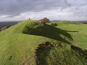
[81] Cow Castle is an Iron Age hillfort occupying an isolated hilltop and has a single rampart and ditch, enclosing 0.9 hectares (2.2 acres).
The walls enclose an area of 9 hectares (22 acres), with the maximum height of 30 feet (9 m) on the northern side.
[107][108] Paleolithic, Mesolithic, and Neolithic flint tools have been found at Glastonbury Tor,[110] which indicates that the site may have been occupied in the Stone Age.
[117] Ham Hill hillfort is surrounded by banks, some of which range up to 12 metres (39 ft) high, and ditches.
[142][143][144][145] An irregular triangular earthwork of 1.75 hectares (4.3 acres) surrounded by the remains of coursed stone walling, with an entrance to the west.
[166] The Ruborough Camp hillfort is on an easterly spur from the main Quantock ridge, with steep natural slopes to the north and south-east.
The fort is triangular in shape, with a single rampart and ditch (univallate), enclosing 1.8 hectares (4.4 acres).
There is a linear outer work about 120 metres (390 ft) away, parallel to the westerly rampart, enclosing another 1.8 hectares (4.4 acres).
Of national importance was the identification of the earliest known metalworking building in Britain, dated to Middle Bronze Age (12th century BC).
[181][182] Evidence shows that Stokeleigh Camp in Leigh Woods was a key site in the defence of the Avon Gorge.
[196][197] Tunley Camp comprises the slight earthwork remains of a univallate Iron Age hillfort, which is now nearly ploughed down.
[202] Wain's Hill is an Iron Age promontory bivallate hillfort visible as linear earthwork banks and ditches.
[206] Westbury Camp is a large, irregularly-shaped hillfort surrounded by a bank and ditch covering approximately 2.3 hectares (5.7 acres).
[208][209] Worlebury Camp is an Iron Age hillfort that was designed for defence, as is evidenced by the number of walls and ditches around the site.
They have found nearly one hundred storage pits of various sizes cut into the bedrock, and many of these had human remains, coins, and other artefacts in them.
[211] However, in more recent times, the fort has suffered damage and been threatened with complete destruction on multiple occasions.
[8][212][213] This site, situated on level ground within an upland area of carboniferous limestone was an Iron Age defended settlement.
A "camp" called Berwick, Berewyke, or Berewyck, adjoining Cottage Crescent and near Barrack Farm, was described in the early 19th century.
[219] The fort may be of Iron Age origin, but was (re)built and fortified as a burh by King Alfred, as part of his defense against Viking raids from the Bristol Channel around 878 AD.