List of neighborhoods in Bakersfield
Generally, its citizens refer to the city by regions, named after directions (for example, the northeast, the northwest, and the southwest).
These regions are further broken down into individual neighborhoods and districts (for example, Stockdale and Seven Oaks are part of the Southwest).
It contains the oldest portions of the city; Downtown, Bakersfield's central business district is located there.
Because of the region's close proximity to the freeway network (State Route 99), railroad mainline (Union Pacific), and air travel (Meadows Field), it is rapidly becoming the center of Bakersfield's distribution industry.
Alfred Harrell Highway serves the Kern River County Park, a 1,014-acre (4.10 km2) recreation area which contains: Hart Memorial Park, California Living Museum (CALM), Lake Ming, and the Kern River Golf Course.
Because the town was created by Southern Pacific, the streets are laid out parallel to their railroad tracks, which are about 45 degrees off from the rest of the city.
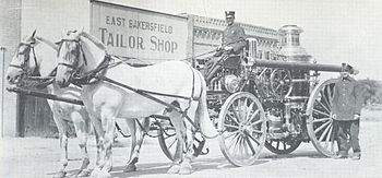
Additionally, because it was a city prior to annexation, East Bakersfield has its own central business district (known as Old Town Kern) centered around the intersection of Baker Street and Sumner Avenue.
Community, Jastro Avenue & Mcnew Court, and the Cottonwood Community, which consists of Reece & Cheatum, Casa Loma Drive, Madison & Adams, Watt's & Lotus, and the East Planz Road & Madison area.
It also includes Casa Loma Elementary, the Career Services Center, and the town of Delkern (most commonly referred to as the Rexland Park Area, or east Greenfield).
State Route 58 travels through the region and is the main link between Bakersfield and all southeast points, including Tehachapi, Mojave, and Barstow.
The Southwest is home to the Park at River Walk, as well as the Marketplace, a major retail shopping center.