List of places of worship in Tonbridge and Malling
Download coordinates as: The borough of Tonbridge and Malling, one of 13 local government districts in the English county of Kent, has more than 80 current and former places of worship.
63 places of worship are in use in the borough, and a further 21 former churches and chapels no longer hold religious services but survive in alternative uses.
Buildings of many styles and sizes are used for Anglican worship: from the tiny tin tabernacles at Hadlow Stair and Golden Green to the expansive stone-built edifices at East Malling and Aylesford, and from Saxon- and Norman-era churches (as at Snodland and Wouldham) to 20th-century buildings in wayside hamlets and on suburban housing estates.
Non-Anglican worshippers are accommodated in a variety of mostly 19th- and 20th-century chapels and meeting rooms: Baptists, Methodists and Roman Catholics each have several churches, and smaller religious groups such as Open Brethren and Jehovah's Witnesses can also be found in the borough.
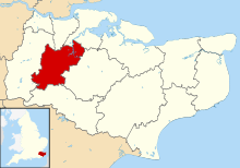
[4] Tonbridge and Malling borough covers 50,440 acres (20,410 ha) of the Kentish Weald in the west of Kent, England's southeasternmost county.
[6] Like many Kentish towns, Tonbridge developed along a main road at a river crossing and grew rapidly in the 19th century, but its ancient origins are visible in its castle and the nearby parish church dedicated to Saints Peter and Paul.
[12] It was a tin tabernacle—a distinctive and cheap type of church building which could be bought from a catalogue and erected quickly where needed.
The heyday of tin tabernacles was the turn of the 20th century, and two green-painted examples survive in religious use in the borough: the Golden Green Mission Church (1914) serves a hamlet near Hadlow and has listed building status,[13] and St Andrew's Church a few miles away serves the Hadlow Stair area of Tonbridge.
[14] The 19th-century Anglican churchbuilding boom in Tonbridge was also prompted by the rise in popularity of Protestant Nonconformist worship, legal restrictions on which had been relaxed steadily since the 17th century.
[45] The Deanery of Shoreham is responsible for Borough Green, Fairseat, Ightham, Platt, Plaxtol, Shipbourne, Stansted and Wrotham.
The 70 by 32 feet (21.3 m × 9.8 m) building was apparently demolished to allow its stonework to be used elsewhere,[213] leaving only the tower standing on a rocky outcrop 1⁄4 mile (0.40 km) southwest of the town.
[212] More recent research casts doubt on this: John Newman, writing in the Buildings of England series in 1969, stated that "[i]n 1198 St Leonard's cemetery is mentioned, and there are later references to a chapel.
[177] English Heritage, in its assessment of the structure written in 1993, made no reference to any former religious use, instead describing it as a "former castle ... one of the best examples of an early Norman keep".