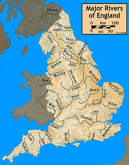
List of rivers of England
Some minor watercourses are included in the list, especially if they are named as 'river'- such examples may be labelled (m).
For simplicity, they are divided here by the coastal sections within which each river system discharges to the sea.
This section includes all rivers entering the Bristol Channel and the sea off the northern coasts of Devon and Cornwall which is referred to variously as the Southwest Approaches or Celtic Sea.
This section includes all tributaries of the Severn which lie wholly or partly in England.
All rivers discharging into the Atlantic Ocean between Land's End, Cornwall and Lyme Regis on the Devon/Dorset border.
There are no watercourses named on either the 1:25,000 or 1:50,000 scale Ordnance Survey maps of the Isles of Scilly.
All rivers discharging into the English Channel and Straits of Dover between Hayling Island on the Hampshire/Sussex border and Foreness Point at the northeast corner of Kent.
But see also Medway catchment Thames catchment All rivers discharging into the North Sea along the coast of East Anglia, including the counties of Essex (north and east of Shoeburyness), Suffolk and Norfolk as far as King's Lynn.
The Humber is often referred to as the River Humber though the name is unusual insofar as it is an entirely tidal stretch of water formed as the Rivers Ouse and Trent combine at Trent Falls.
This section includes all rivers meeting the North Sea coast of the traditional county of Yorkshire, save for the Humber and Tees.
Except where otherwise unannotated, rivers and other watercourses in this list are taken from the various sheets of the 1:25,000, 1:50,000 and 1:63,360 scale map series of the Ordnance Survey of Great Britain.