Loran-C
[6] The National Timing Resilience and Security Act of 2017, proposed resurrecting Loran as a backup for the United States in case of a GPS outage caused by space weather or attack.
During the initial meetings, a member of the UK liaison team, Taffy Bowen, mentioned that he was aware the British were also working on a similar concept, but had no information on its performance.
In spite of several efforts to design around the problem, instability in the display prevented accurate measurements as the output shifted back and forth on the face of the oscilloscope.
This meant that pulse-matching could be used to get a rough fix, and then the operator could gain additional timing accuracy by lining up the individual waves within the pulse, like Decca.
Beetle was located in the far north, on the Canada-Alaska border, and used new guy-stayed 625 feet (191 m) steel towers, replacing the earlier system's balloon-lofted cable antennas.
The tests also showed that the system was extremely difficult to use in practice; it was easy for the operator to select the wrong sections of the waveforms on their display, leading to significant real-world inaccuracy.
As the United States Army Air Forces were moving towards smaller crews, only three in the Boeing B-47 Stratojet for instance, a high degree of automation was desired.
[19] Through this period the issue of radio spectrum use was becoming a major concern, and had led to international efforts to decide on a frequency band suitable for long-range navigation.
The result of this final operation would become negative during a very specific and stable part of the rising edge of the pulse, and this zero-crossing was used to trigger a very short-time sampling gate.
[24] Around this period the United States Navy began work on a similar system using combined pulse and phase comparison, but based on the existing LORAN frequency of 200 kHz.
At the time global charts were printed with shaded sections representing the area where a 3-mile (4.8 km) accurate fix could be obtained under most operational conditions.
[27] In 1969, Decca sued the United States Navy for patent infringement, producing ample documentation of their work on the basic concept as early as 1944, along with the "missing" 9f frequency[c] at 98 kHz that had been set aside for experiments using this system.
Although MUTNS was unrelated to the Loran systems, it was sometimes referred to as Loran-F.[32] In spite of its many advantages, the high cost of implementing a Loran-C receiver made it uneconomical for many users.
GPS was more difficult to receive and decode, but by the 1990s the required electronics were already as small and inexpensive as Loran-C, leading to rapid adoption that has become largely universal.
[2][3] The European Union had decided that the potential security advantages of Loran are worthy not only of keeping the system operational, but upgrading it and adding new stations.
In comparison to angle measurements, these remain fairly steady over time, and most of the effects that change these values are fixed objects like rivers and lakes that can be accounted for on charts.
Timing the difference between two signals can be easily accomplished, first by physically measuring them on a cathode-ray tube, or simple electronics in the case of phase comparison.
[39] Where available, common marine nautical charts include visible representations of TD lines at regular intervals over water areas.
The color on official charts for stations and the timed-lines of position follow no specific conformance for the purpose of the International Hydrographic Organization (IHO).
Due to interference and propagation issues suffered from land features and artificial structures such as tall buildings, the accuracy of the LORAN signal can be degraded considerably in inland areas (see Limitations).
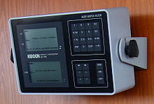
Traditional LORAN receivers display the time difference between each pairing of the primary and one of the two selected secondary stations, which is then used to find the appropriate TD line on the chart.
At night the indirect skywave, bent back to the surface by the ionosphere, is a problem as multiple signals may arrive via different paths (multipath interference).
In 2001, data similar to Wide Area Augmentation System (WAAS) GPS correction messages were sent as part of a test of the Alaskan LORAN chain.
Senator Collins, the ranking member on the Committee on Homeland Security and Governmental Affairs wrote that the President's budget overview proposal to terminate the LORAN-C system is inconsistent with the recent investments, recognized studies and the mission of the U.S. Coast Guard.
"This proposal is inconsistent with the recently released (January 2009) Federal Radionavigation Plan (FRP), which was jointly prepared by DHS and the Departments of Defense (DOD) and Transportation (DOT).
The release of the report followed an extensive Freedom of Information Act (FOIA) battle waged by industry representatives against the federal government.
[51] In November 2009, the U.S. Coast Guard announced that the LORAN-C stations under its control would be closed down for budgetary reasons after 4 January 2010 provided the Secretary of the Department of Homeland Security certified that LORAN is not needed as a backup for GPS.
Seven differential reference stations provided additional position, navigation, and timing (PNT) information via low-frequency pulses to ships fitted with eLoran receivers.
The service was to help ensure they could navigate safely in the event of GPS failure in one of the busiest shipping regions in the world, with expected annual traffic of 200,000 vessels by 2020.
[56] Despite these plans, in light of the decision by France and Norway to cease Loran transmissions on 31 December 2015, the UK announced at the start of that month that its eLoran service would be discontinued on the same day.