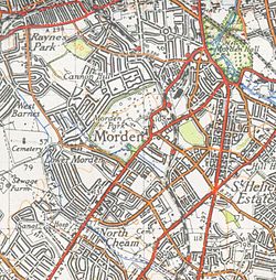
Lower Morden
Today nothing of the original hamlet remains except perhaps a few ancient trees and old field boundary lines followed by the alignments of the roads that were to replace them.
The loss of Morden Common followed, its area now occupied by the Merton & Sutton Joint Cemetery and the Garth Road Industrial Estate.
Up to the Second World War the marshy land either side of the Pyl Brook now used as playing fields was cow pasture.
The majority of residential development took place in the late 1930s with mock Tudor style houses being built between Morden Park and Stonecot Hill and north between Grand Drive, Hillcross Avenue and Cannon Hill Lane.
The Lower Morden ward had one of the lowest crime rates in Greater London in the 2014/15 period.