M-22 (Michigan highway)
The highway is U-shaped as it rounds the peninsula running through tourist areas in Leland and Suttons Bay in addition to the national lakeshore.
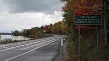
The highway marker is used in marketing by a local business as a symbol of the region, a trademark for which has been the subject of legal controversies.
In between the trunkline loops north along Lake Michigan to Northport before turning south along the West Arm of Grand Traverse Bay.
South of the Platte River, the highway crosses into the Sleeping Bear Dunes National Lakeshore.
The roadway follows the shoreline of Pyramid Point and passes east out of the national park before turning north to Leland.
It passes through the reservation of the Grand Traverse Band of Chippewa and Ottawa Indians in Peshawbestown, home to one of the tribe's two casinos.
[4] Broneah Kiteboarding, a company based in Traverse City, has adopted the M-22 marker as a logo and sells merchandise such as clothing and bumper stickers featuring it.
[6] The private corporation has attempted to trademark the road sign, which has been legally opposed by the Michigan Attorney General Bill Schuette;[7] that formal opposition was removed by his successor Dana Nessel in 2019.
The state had replaced about 90 signs in the previous three years,[11] and a department spokesman said the popularity of the highway from merchandise sales and scenic travelers factored into those thefts.
[12] The new signs will be installed as replacements in the areas with the most thefts, like Leelanau County,[13] while the rest of the highway will still receive the standard M-22 marker.