Marbury, Cheshire
A middle Bronze Age palstave, a type of axe, was found at Bank Farm, near Marbury village; it dates from around 1000–1200 BC.
[11] The manor of Marbury was later owned by the de Praers family of Baddiley, passing to John le Strange, Lord of Whitchurch, before 1349.
[17][18][19] In June 1551, sixteen people in Marbury died in an epidemic of "sweating sickness", perhaps influenza, which also claimed the life of the mayor of Chester, Edmund Gee.
[22] In the Civil War, Thomas Marbury declared for Parliament and raised troops which fought at the Parliamentarian stronghold of Nantwich in 1643–44.
In common with much of the countryside surrounding Nantwich, Marbury was plundered by both sides between 1642 and 1644, with the Royalist commander Lord Capell quartering troops in the parish in 1643.
The Leathern Bottle had closed by the end of the 19th century, while The Swan was rebuilt in around 1884 by Cudworth Halstead Poole, and remains open as of 2024.
[26] Historian George Ormerod described the village in around 1816 as "a cluster of farm-houses, occupying rising ground between two small meres or lakes, from which the township derives its name.
[36] The completion of the Ellesmere Canal early in the 19th century and the Crewe and Shrewsbury Railway in 1858 improved transport for local produce, particularly cheese and milk, to cities including London and Liverpool.
At that date, Marbury had two blacksmiths, butchers and shoemakers, and a wheelwright; later there was also a smithy, coal merchant, tailor, bakehouse and one or more grocer's shops.
[38] In the early 20th century, the great majority of the population was still employed in agriculture; one contemporary observer mentioned common occupations as "farm workers, milkmaids and washer women".
Ornithologist T. A. Coward wrote around 1900: "What a country this is, wooded hills, none of them high, lanes bordered with luxuriant vegetation that tempts one to potter and smell the honeysuckle or pick the wild roses; meres or pools in almost every hollow.
"[28] Almost 50 years later, little had changed; local author Beatrice Tunstall described the village in 1948 as "far from the madding crowd", and praised the "ancient lanes, deep trodden by the feet of endless generation, flower fringed amid the woodlands, with great hedges where honeysuckle and wild roses riot.
"[40] A total of 86 men from Marbury served in the First World War; Belgian refugees supplied some of the resulting deficit in agricultural labour.
[26] The second half of the 20th century also saw the loss of many local businesses, with the smithy being demolished in 1979, and the last remaining village shop closing before 1999.
In 1866, the legal definition of 'parish' was changed to be the areas used for administering the poor laws, and so Marbury cum Quoisley and Norbury became separate civil parishes.
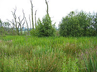
[59][60] The Marbury and Quoisley Meres originate in glacial kettle holes, formed at the end of the last ice age some ten or fifteen thousand years ago.
An unnamed brook running from Wirswall Road via Quoisley Meres to the canal forms part of the southern boundary.
[66] A small area in the south east falls within the parkland of Combermere Abbey, which is listed in the National Register of Historic Parks and Gardens at grade II.
[61][71] Marbury Big Mere is a private fishing lake run by the Prince Albert Angling Society, with roach, perch, pike, tench, bream, and common and mirror carp being the main species.
[58] The Anglican parish church of St Michael and All Angels stands on a low rise overlooking Marbury Big Mere.
[59] Overlooking the green on Wrenbury Road is The Swan, a popular country pub dating originally from 1765, but completely rebuilt in around 1884.
[82][83][84] Marbury Cottage on Church Lane dates originally from the late 16th or early 17th century and is believed to have formerly been a dower house.
The original house dates from the late 16th or early 17th century and features close studding; it has a projecting wing with a jettied gable.
[86][83] Finally, a two-storey outhouse on Wirswall Road adjacent to The Swan dates from the 17th century, and features small framing with brick infill.
[92][93] Architecture writers Peter de Figueiredo and Julian Treuherz describe it as "pretty", with "playful" ornamentation.
[30] Hadley Hall, on Wirswall Road at SJ557461, is a grade-II-listed, timber-framed farmhouse with red brick infill, originally dating from the 16th century.
The base has inset panels of red sandstone on each face; one has a doorway, while the opposite one bears the Cotton coat of arms and a memorial inscription.
[98][100][101] The design is similar to Sir Robert Smirke's monument to the Duke of Wellington, Lord Combermere's former commanding officer, in Phoenix Park, Dublin.
[59][60] The Welsh Marches railway line runs through the civil parish from the north east to the south west; the nearest stations are Wrenbury and Whitchurch.
[105][106] At past fairs, entertainments have included displays of farm machinery, vintage cars and motor cycles, and model railways and aircraft, as well as historical reenactments, puppet shows, clay pigeon shooting, raft and cross country races, sheepdog trials and other dog displays.