March (territory)
More specifically, a march was a border between realms or a neutral buffer zone under joint control of two states in which different laws might apply.
In both of these senses, marches served a political purpose, such as providing warning of military incursions or regulating cross-border trade.
[3] Historians interpret the aprisio both as the basis of feudalism and in economic and military terms as a mechanism to entice settlers to a depopulated border region.
[citation needed] After some early setbacks, Emperor Louis the Pious ventured beyond the province of Septimania and eventually took Barcelona from the Moorish emir in 801.
The Carolingian "Hispanic Marches" (Marca Hispanica) became a buffer zone ruled by a number of feudal lords, among them the count of Barcelona.
It had its own outlying territories, each ruled by a lesser miles with armed retainers, who theoretically owed allegiance through a count to the emperor or, with less fealty, to his Carolingian and Ottonian successors.
Such territory had a catlá ("castellan" or lord of the castle) in an area largely defined by a day's ride, and the region became known, like Castile at a later date, as "Catalunya".
[citation needed] The province of France called Marche (Occitan: la Marcha), sometimes Marche Limousine, was originally a small border district between the Duchy of Aquitaine and the domains of the Frankish kings in central France, partly of Limousin and partly of Poitou.
[5] Marche first appeared as a separate fief about the middle of the 10th century when William III, duke of Aquitaine, gave it to one of his vassals named Boso, who took the title of count.
[5] The family of Armagnac held it from 1435 to 1477, when it reverted to the Bourbons, and in 1527 it was seized by King Francis I and became part of the domains of the French crown.
In 1080, the marca Anconitana was given in investiture to Robert Guiscard by Pope Gregory VII, to whom the Countess Matilda ceded the marches of Camerino and Fermo.
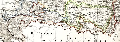
One of these territories was Austrian Littoral, which Italian nationalists began to call the Julian March because of its positioning and as an act of defiance against the hated Austro-Hungarian empire.
A map of the Duchy of Mantua in 1702 (Braudel 1984, fig 26) reveals the independent, though socially and economically dependent arc of small territories from the principality of Castiglione in the northwest across the south to the duchy of Mirandola southeast of Mantua: the lords of Bozolo, Sabioneta, Dosolo, Guastalla, the count of Novellare.
Portions of the gyepű were usually guarded by tribes who had joined the Hungarian nation and were granted special rights for their services at the borders, such as the Székelys, Pechenegs and Cumans.
During the 17th and 18th centuries these borderlands were called Markland in the area of Transylvania that bordered with the Kingdom of Hungary and was controlled by a Count or Countess.
The English title was a foreign importation from France, tested out tentatively in 1385 by Richard II, but not naturalized until the mid-15th century, and now more often spelled "marquess".
The Chinese concept of March is called Fan (藩), referring to feudatory domains and petty kingdoms on the borderlands of the empire.
In their initial development during the later Zhou dynasty, the commanderies (jùn, 郡) functioned as marches, ranking below the dukes' and kings' original fiefs and below the more secure and populous counties (xiàn).
As the commanderies formed the front lines between the major states, however, their military strength and strategic importance were typically much greater than the counties'.
By guarding the border, rather than conquering or colonizing Ezo, the Matsumae, in essence, made the majority of the island an Ainu reservation.
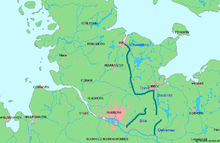
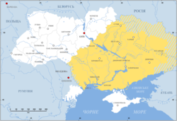
Ukraine, from the Moscow-centric Russian viewpoint, functioned as a "borderland" or "march" and arguably could have gained its current name, which is derived from a Slavic term that can take on the same meaning (see above for similar in Slovenia, etc.
[citation needed] This, though, was merely a continuation of a semi-formal arrangement with the Poles, before escalating feuds, political infighting in Poland, and religious differences (mainly Eastern Orthodox vs. Roman Catholic) saw a loose coalition of Ukrainian lords and independent landowners collectively known as the Cossacks shift to ally with the Russian Empire.
The Tatar slave raids in East Slavic lands brought considerable devastation and depopulation to this area prior to the rise of the Zaporozhian Cossacks.