Marienberg
The town is situated on a plateau north of the Ore Mountains ridge, at an elevation between 460 and 891 metres above sea level.
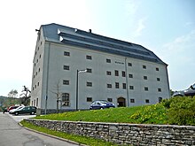
The historical town centre follows a rectangular plan, imitating Italian renaissance.
In the wake of a fever (Faulfieber) epidemic, an orphanage was founded in 1772, which was expanded into a school (Freischule) in 1805.
In 1835, the dilapidated town wall was taken down, with the exception of the Zschopau Gate (Zschopauer Tor) and the Red Tower (Roter Turm).
In 1847, the mining office was closed; that same year a kindergarten was opened in the presence of Friedrich Wilhelm August Fröbel.
In 1914, the church, the Red Tower and the Zschopau Gate were placed under protection by a local by-law.
Towards the end of World War II, 154 concentration camp prisoners from the subcamp of Wille in Tröglitz/Rehmsdorf were murdered during a death march by members of the SS.
They had escaped from transport trains at Gelobtland and Reitzenhain stations during enemy strafing attacks between 15 and 17 April 1945 into the surrounding forests, but were recaptured.
Since 2013, there are no more scheduled passenger trains to Marienberg,[4] while the section of the railway line to Reitzenhain was already closed in 1998.
Marienberg is developing its tourism offer; one aspect of that being the Silver Road which runs through the town.
A German armoured infantry unit, the Panzergrenadierbataillon 371, is based in the Bundeswehr barracks called Erzgebirgskaserne.
The B 174 federal highway from Chemnitz runs through the town towards Reitzenhain (border of Czech Republic), and crosses B 171 from Wolkenstein to Dippoldiswalde near Hüttengrund.
The construction of the ring road, planned for many years, which routes the B 174 east of Marienberg, was started in 2005.
Public transport is provided by VMS with scheduled cross-country buses to Annaberg-Buchholz, Brand-Erbisdorf, Chemnitz, Freiberg, Niederschmiedeberg, Olbernhau, Wolkenstein, and Zschopau as well as local buses connecting the various parts of the town.
MEF (Mittel-Erzgebirgs-Fernsehen), a TV station, has been operating since 1989 and aims to provide a broadcasting platform for the community of the county of Mittlerer Erzgebirgkreis.