Marjayoun
[1] In 1596, 'Jadida' appears in the daftar of Ottoman nahiya (subdistrict) of Tibnin in the liwa' (district) of Safad, as a Muslim village of 28 households and 12 bachelors.
[9] On August 10, 2006, after the breakdown of ceasefire negotiations in the 2006 Lebanon War, Israeli forces took control of Marjayoun.
The convoy was attacked by the Israeli Air Force (IAF) northeast of Hasbaya en route to Kefraya, in the south of the Bekaa valley.
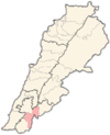
[11] Marjayoun is 860 metres (2,822 ft) above sea level, standing on the west side of the Jordan Rift Valley just across from the ancient regional capital, Caesarea Philippi, which was located at the foot of Mount Hermon on the east side of the Rift Valley.
Marjeyoun stands on a hill facing Mt Hermon to the east, the Crusader castle of Beaufort, set above the Litani River and overlooking Mount Amel (Jabal Amel), to the west, the Mount Lebanon range with the Rihan and Niha peaks to the north, with the fertile Marjeyoun plains extending southward into the Galilee plains and the Golan Heights.
[15] Marjayoun is the seat of the Melkite (Greek Catholic) Archeparchy of Baniyas, which includes the southeastern part of Lebanon.
[citation needed] Marjayoun is home to a regional government hospital founded in 1960,[17] and a Lebanese Red Cross First Aid Center.