Mason County, West Virginia
Mason County is part of the Point Pleasant, WV-OH Micropolitan Statistical Area.
In the second half of 1749, the French explorer, Pierre Joseph Céloron de Blainville, claimed French sovereignty over the Ohio Valley, burying a lead plaque at the meeting point of the Ohio and Kanawha Rivers, naming the place Point Pleasant.
In the Battle of Point Pleasant (October 10, 1774), fought on the future site of the town, over one thousand Virginia militiamen, led by Colonel Andrew Lewis (1720–1781), defeated a roughly equal force of an Algonquin confederation of Shawnee and Mingo warriors led by Shawnee Chief Cornstalk (ca.
According to Hardesty's West Virginia Counties (1883), regarding the first white settlers in Mason County south of Point Pleasant: All that part of the district lying on the Ohio river bottoms above Eighteen-mile Creek, was included in the grant made by Congress to the heirs of General Mercer, who was killed at the battle of Princeton, New Jersey, January 3, 1777, while fighting by the side of Washington; hence the name Mercer Bottom.
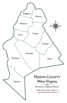
Thomas Hannan, whose name is preserved in that of the district, was the first actual settler - locating in the year 1790.
Andrew Fleming and a Mr. Mercer, two hunters, had previously erected a cabin on the land which he purchased, and this was occupied by him until he could build a better one.
Soon Jesse George purchased seventy acres of land at the mouth of Flatfoot Creek ... and became the second actual settler.
Then came John Hereford, Robert Hereford, Thomas Powell, Edward S. Menager, John Morris — who discovered the first salt water on Kanawha river — George Withers, Robert Cremeans, James George, Rev.
John Canterbury ...The settlement at Point Pleasant did not receive an official charter until 1794.
The first road through what later became Mason County was laid out by Thomas Hannan (1757-1835) in 1798 under contract to the federal government.
It traversed the distance from present-day St Albans, (West) Virginia to Chillicothe, Ohio.
Meanwhile, William W. Newman claimed to represent Mason as well as nearby Jackson, Cabell, Wayne and Wirt counties throughout the war.
[5] In March 1863, in the only wartime skirmish in Mason County, during the Jones-Imboden Raid, the 6th Virginia Cavalry and 8th Virginia Cavalry attacked the Mason County Courthouse, where they believed munitions stored, leaving bullet holes in the walls until a replacement was built in 1954.
The park includes the tavern begun in 1796 by Walter Newman, later operated as a museum of local history by the Daughters of the American Revolution.
The Marietta Manufacturing Company (shipbuilders) moved to Point Pleasant in 1915; the facility continued to build mine-planting vessels and other small ships through World War II, but closed in 1970.
During World War II the West Virginia Ordnance Works manufactured TNT in Mason County about 5 miles north of Point Pleasant; it was later repurposed as the McClintic Wildlife Management Area as well as an industrial park.
[9] Prior to its establishment in 1804, the land that would become Mason County was part of the vast and largely unorganized territory claimed by Virginia west of the Alleghenies.
Mason County is the primary setting of the analog horror web series Local 58.