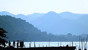
Mayurakshi River
Many of the rivers that originate on the Chota Nagpur Plateau, including the Mayurakshi, and flow down into West Bengal are rain fed and have for ages wrought havoc with their seasonal floods.
For the district of Birbhum, O'Malley has noted "in 1787 there was a high flood which it is said, in some places swept off villages, inhabitants and cattle, the crops on the ground, with everything that was moveable."
In September 1902, because of heavy rains the Brahmani and the Mayurakshi overflowed their banks and inundated the surrounding country in some places to the depth of 4 to 6 metres (12 to 20 ft) [4] From the counterpart rupee fund created through supplies of wheat and other materials from Canada for use in India, Canada devoted those rupees to the further development of the Mayurakshi dam project.
[6] Unfortunately, the Massanjore dam located near Dumka in the state of Jharkhand (erstwhile Bihar) was not allowed to have any flood reserve.
Simultaneously with construction of dams the state government in 1956, selectively took over flood control embankments till then maintained by the landlords or local bodies.
The reservoir has an area of 67.4 square kilometres (16,650 acres) when full and has a storage capacity of 617,000,000 cubic metres (500,210 acre⋅ft).
Major embankments line long stretches of such rivers as Mayurakshi, Dwarka, Brahmani and Ajay [4][8] Massanjore dam has ensured irrigation of some 2,400 square kilometres (600,000 acres) of land with an estimated resultant increased yield of approximately 400,000 tons of food annually [9] and generation of 2,000 kW of electric power.