Mediterranean basin
It is distinct from the drainage basin, which extends much further south and north due to major rivers ending in the Mediterranean Sea, such as the Nile and Rhône.
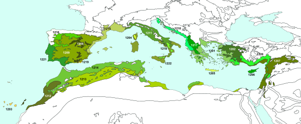
The Mediterranean region offers an ever-changing landscape of high mountains, rocky shores, impenetrable scrub, semi-arid steppes, coastal wetlands, sandy beaches and a myriad of islands of various shapes and sizes dotted amidst the clear blue sea.
In West Asia, it covers the western and southern portions of the Anatolian Peninsula, as far as Iraq,[4] but excluding the temperate-climate mountains of central Turkey.
As Africa–Arabia moved north, it closed the former Tethys Sea, which formerly separated Eurasia from the ancient super continent of Gondwana, of which Africa was part.
At about the same time, 170 mya in the Jurassic period, a small Neotethys ocean basin formed shortly before the Tethys Sea was closed at the eastern end.
About 6 mya during the late Miocene, the Mediterranean was closed at its western end by drifting Africa, which caused the entire sea to evaporate.
[5] Recent research has suggested that a desiccation-flooding cycle may have repeated several times [6][7] during the last 630,000 years of the Miocene epoch, which could explain several events of large amounts of salt deposition.
Fossil evidence shows that the Mediterranean basin had a relatively humid subtropical climate with summer rainfall during the Miocene, which supported laurel forests.
The subtropical laurel forests retreated, although they persisted on the islands of Macaronesia off the Atlantic coast of Iberia and North Africa, and the present Mediterranean vegetation evolved, dominated by coniferous trees and sclerophyllous trees and shrubs, with small, hard, waxy leaves that prevent moisture loss in the dry summers.
Among the endemic species prominent in the Mediterranean vegetation are the Aleppo pine (Pinus halepensis), stone pine (Pinus pinea), Austrian pine (Pinus nigra), Pinus pinaster, Pinus sylvestris, Mediterranean cypress (Cupressus sempervirens), bay laurel (Laurus nobilis), Oriental sweetgum (Liquidambar orientalis), holm oak (Quercus ilex), Quercus rotundifolia, kermes oak (Quercus coccifera), Quercus pubescens, Quercus suber, Quercus robur, Quercus petraea, Carob (Ceratonia siliqua), strawberry tree (Arbutus unedo), Greek strawberry tree (Arbutus andrachne), mastic (Pistacia lentiscus), terebinth (Pistacia terebinthus), Pistacia atlantica, common myrtle (Myrtus communis), oleander (Nerium oleander), almond (Prunus amygdalus), Acanthus mollis, Vachellia tortilis, Phoenix canariensis, date palm (Phoenix dactylifera), Salix alba, Juglans regia, Erica arborea, Populus nigra, Vachellia flava, Balanites aegyptiaca, Senegalia senegal, Prosopis cineraria, Aerva javanica, Ziziphus spina-christi, Juniperus communis, Prunus padus, Picea abies, Abies alba, Alnus glutinosa, Fagus sylvatica, Taxus baccata, Acer pseudoplatanus, Malus sylvestris, Viburnum lantana, Fraxinus excelsior, Tilia cordata, Aesculus hippocastanum, Rhamnus cathartica, Ulmus glabra, Ulmus minor, Populus alba, Populus tremula, Betula pendula, Corylus avellana and Vitex agnus-castus.
Food crops, including wheat, chickpeas, and olives, along with sheep and goats, were domesticated in the eastern Mediterranean in the 9th millennium BCE, which allowed for the establishment of agricultural settlements.
A strengthening of the summer monsoon 9000–7000 years ago increased rainfall across the Sahara, which became a grassland, with lakes, rivers, and wetlands.
Goitein's multivolume study of the Cairo Geniza documents was another important contribution in the area of Mediterranean Jewish culture.

Desert climate Semi-arid climate
Mediterranean climate Humid subtropical climate
Oceanic climate Humid continental climate
Subarctic climate Tundra