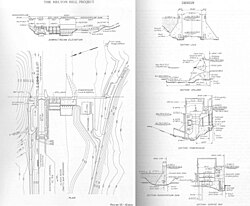
Melton Hill Dam
Melton Hill Dam was named for a knob atop nearby Copper Ridge where the United States Coast and Geodetic Survey installed a triangulation station in 1884.
Melton Hill Dam is located 23 miles (37 km) upstream from the mouth of the Clinch, stretching across the Roane-Loudon county line.
Melton Hill's tailwaters are part of Watts Bar Lake, a main Tennessee River channel impoundment that extends across the lower 23 miles (37 km) of the Clinch.
[1] Melton Hill Lake provides nearly 193 miles (311 km) of shoreline and 5,470 acres (22 km²) of water surface for navigation and recreation, and includes parts of Loudon, Roane, Anderson, and Knox counties.
TVA first proposed the Melton Hill project in 1957, and after several years of lobbying, Congress agreed to fund the dam's construction.
The project's most problematic relocation issue involved an experimental farm operated by the Agricultural Research Laboratory, a joint initiative of the AEC and the University of Tennessee.