Merrifield, Virginia
Merrifield is a census-designated place (CDP) in Fairfax County, Virginia, United States.
[4] It is bounded by I-66 on the north, the Capital Beltway on the east, Arlington Boulevard (U.S. Route 50) on the south, and Nutley Street (Virginia State Highway 243) on the west.
Neighboring communities are Oakton to the west, the town of Vienna to the north, Dunn Loring to the northeast, Idylwood and West Falls Church to the east, Annandale at the southeast corner of Merrifield, Woodburn and Mantua to the south, and the city of Fairfax to the southwest.
[5] As of the 2020 census (some information from the 2022 American Community Survey) there were 20,488 people, 9,616 housing units and 9,121 households residing in the CDP.
Of the residents, 4.1% had Italian ancestry, 49.7% spoke a language other than English at home, and 43.3% were born outside the United States, 45.3% of whom were naturalized citizens.
The FCPS headquarters are located in the Gatehouse Administration Center within the Merrifield CDP.
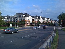
[6][7] The Mosaic District is a mixed-use complex in the format of an ersatz downtown, with buildings lining urban-style streets.